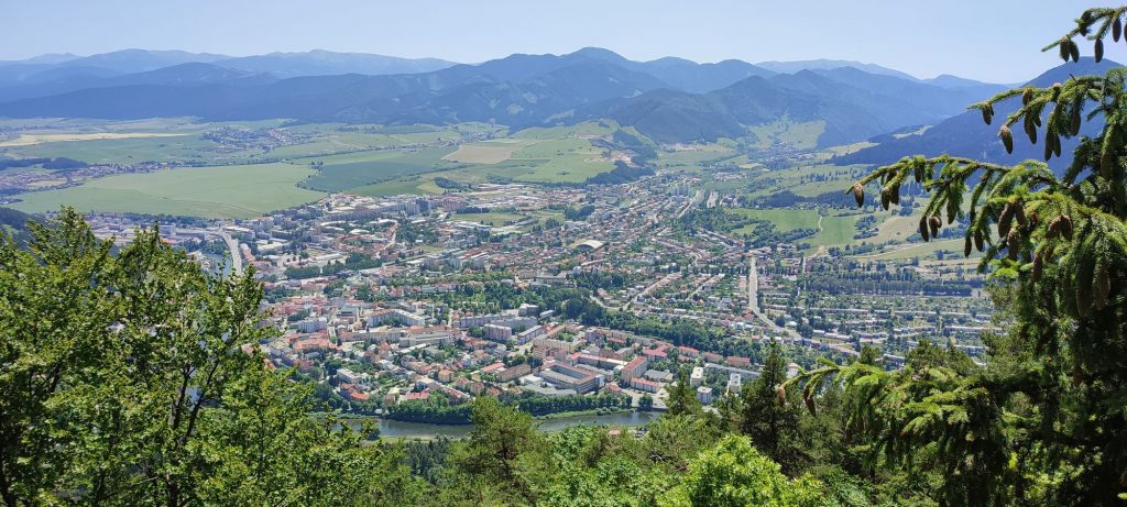
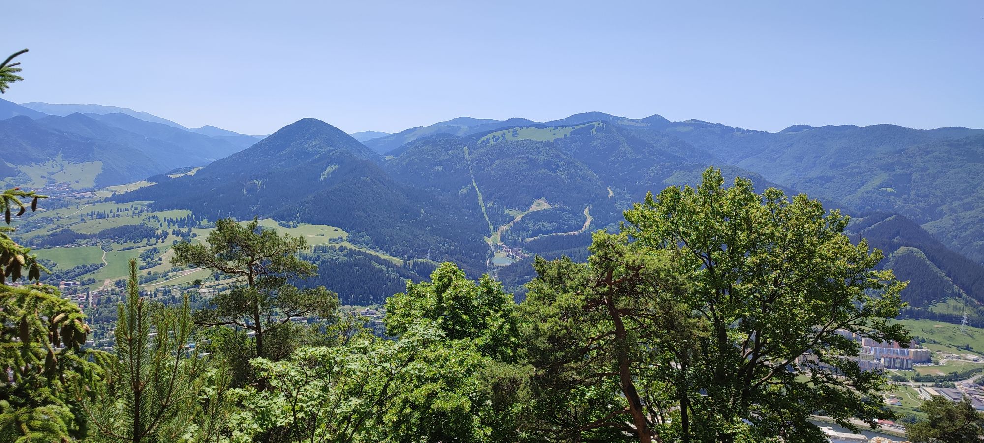
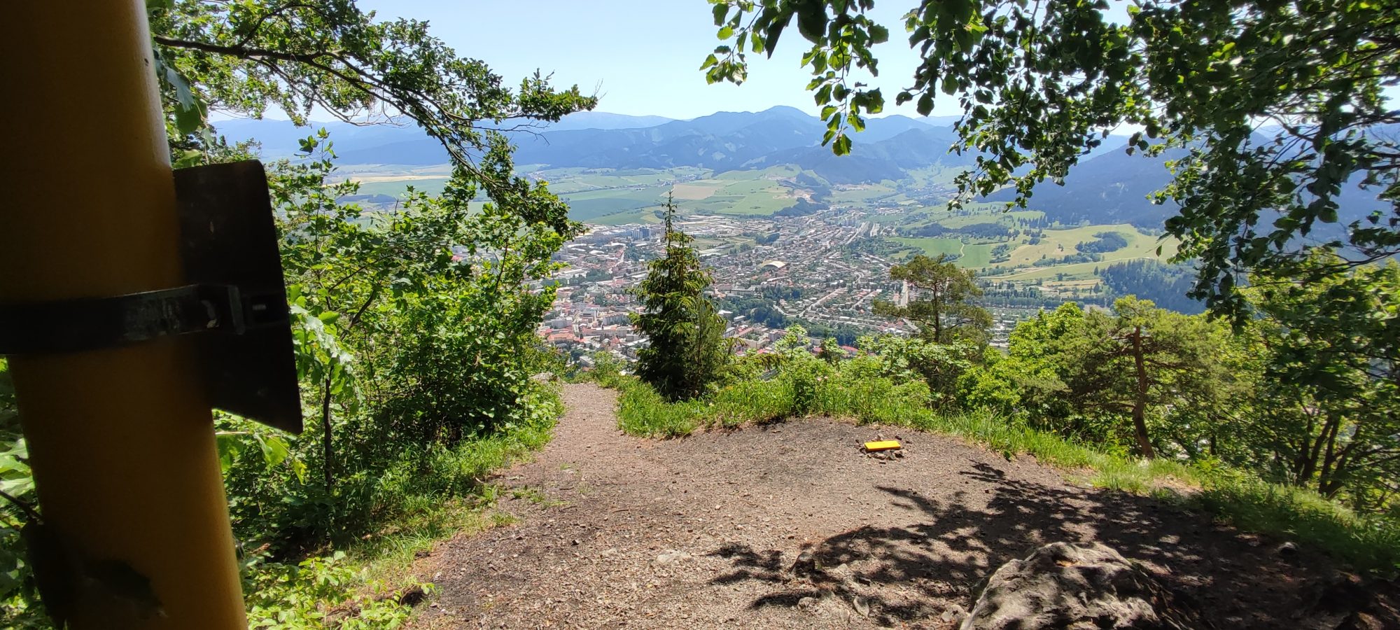
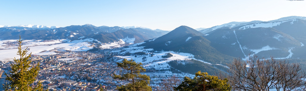
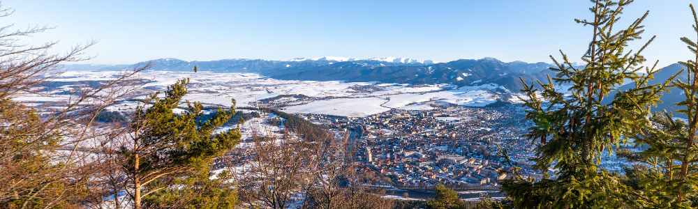
The viewpoint on Predny Čebrat is one of the most sought-after places, especially by locals. The view from the top provides a unique view of the city of Ružomberok, the Liptov Basin and the surrounding mountains. The ascent route to the peak is named after Zdenek Hochmuth, in whose honor a memorial plaque is placed on the peak. The peak is accessible all year round and the climb to it is slightly more difficult.
The starting tourist signpost is located next to the road, between the bus and railway stations in Ružomberok. A green marked tourist route leads from the signpost to the top. The markings lead us past the bus station, after which we turn right to a railway crossing for pedestrians. Behind the tracks, it continues left, parallel to the railway line. It passes under a bridge, after which we turn right into the forest in front of apartment buildings. The trail leads alternately between trees and small meadows, past a well to the Hlivovo recreational meadow. It continues left on it. If interested, we can rest in a shelter with seating on the meadow. The trail leads us from Hlivovo to a forest road, from which, however, after about a hundred meters we turn right into the trees. A steeper path through overgrown felling will lead us to the forest. A gently ascending, winding trail then helps us to overcome steep slopes. At the end below the summit, the trail splits several times. We recommend always using the one with the lowest gradient to reach the destination safely.
Warning: The viewpoint on the cliff is not secured against falls.
Predný Čebrať rises north of Ružomberok. Its pyramidal shape forms a dominant feature visible from almost the entire city. It is 1.7 km (as the crow flies) from the city center. A green marked hiking trail leads to the top.
Transport:
By bus, public transport: stop “Železničná stanica”
By suburban bus: stop “Ružomberok,,AS”
By car: parking at the railway station
By train: station “Ružomberok”
Distance:
From the starting point between the railway and bus stations in Ružomberok 3.6 km.
Upon return, we can use the services of a restaurant, refreshments or catering service near the start of the route in Ružomberok. Accommodation will be provided by accommodation facilities in Ružomberok or Likavka.