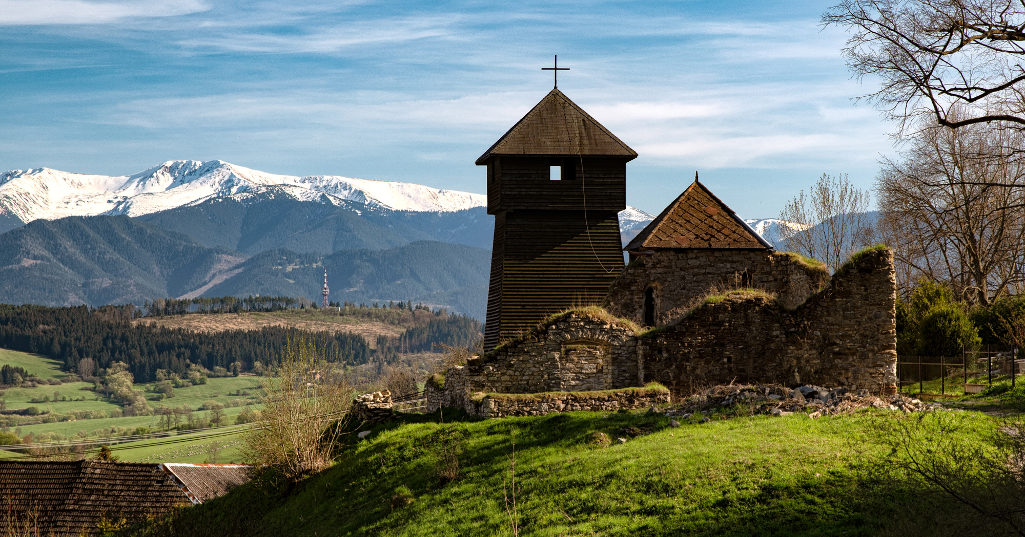
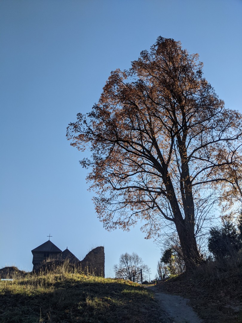

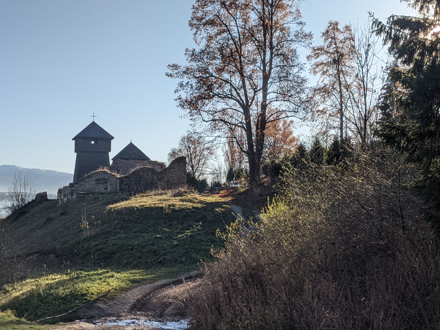
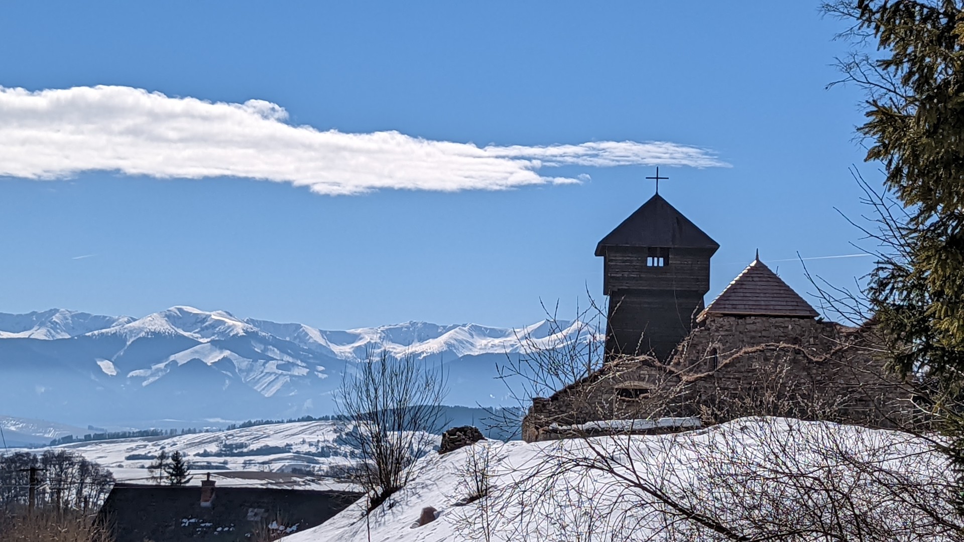


I parked my car at the end of the village near the wooden bell tower, which turned out to be the ruins of a 13th-century church that burned down in 1805. We first turn into the last street in the village, but here the map fools us and the path simply ends at a gate, behind which the owner was shouting at some barking dogs and, apparently for the fourth time, had to explain that the real route is higher up the slope. You just need to walk a little deeper into the valley.
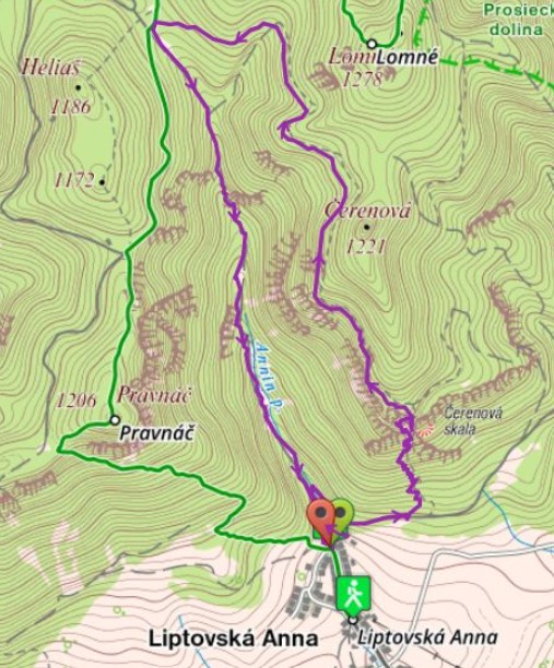
Steep paths to Jánošíkov stôl
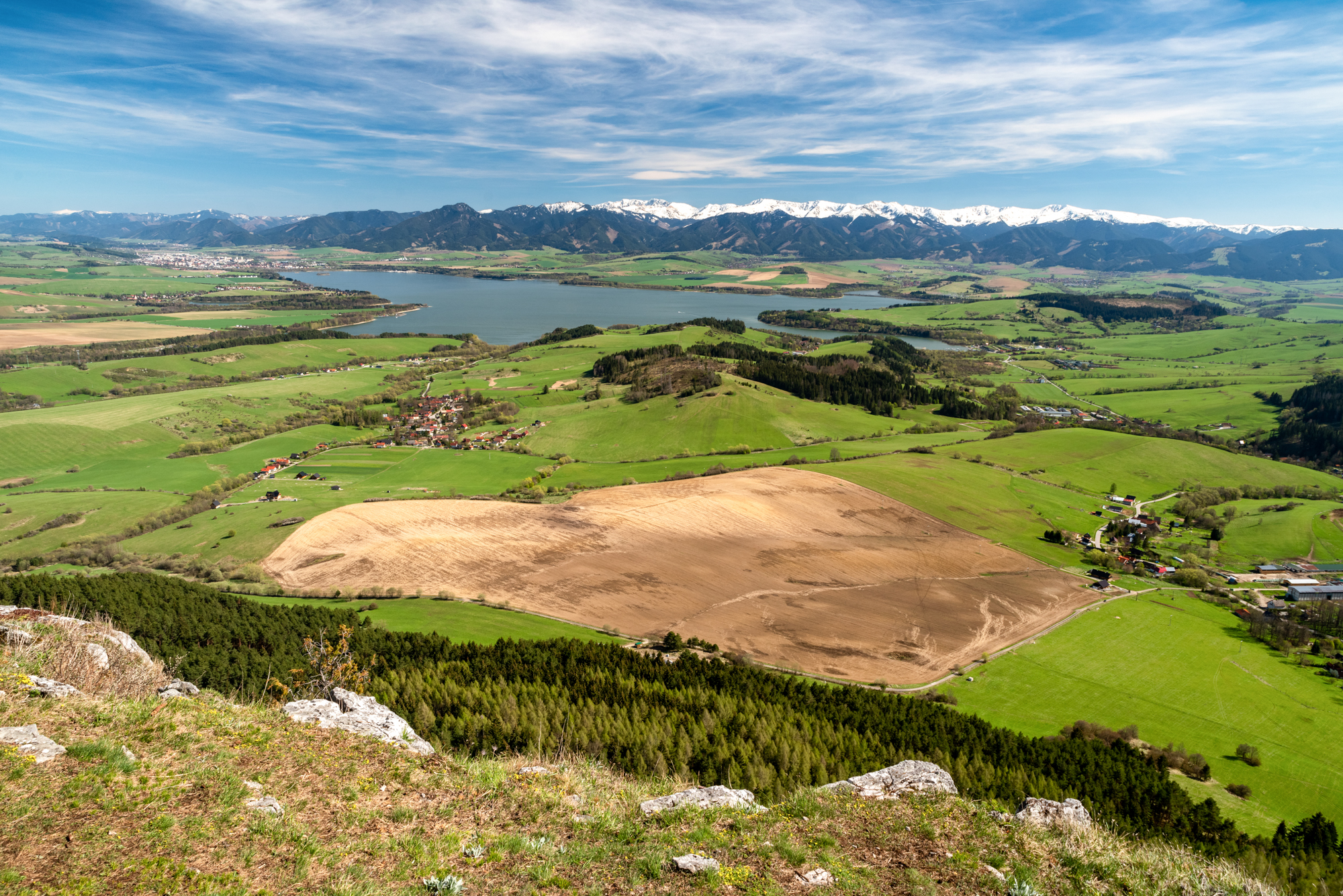
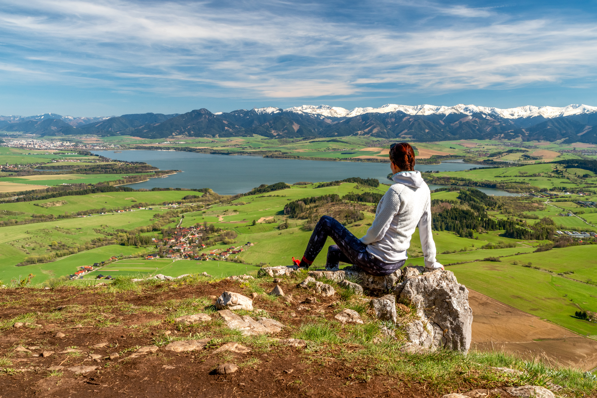
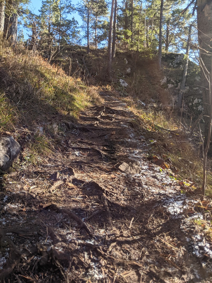
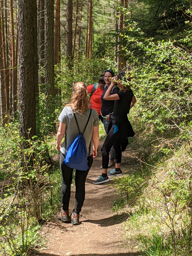
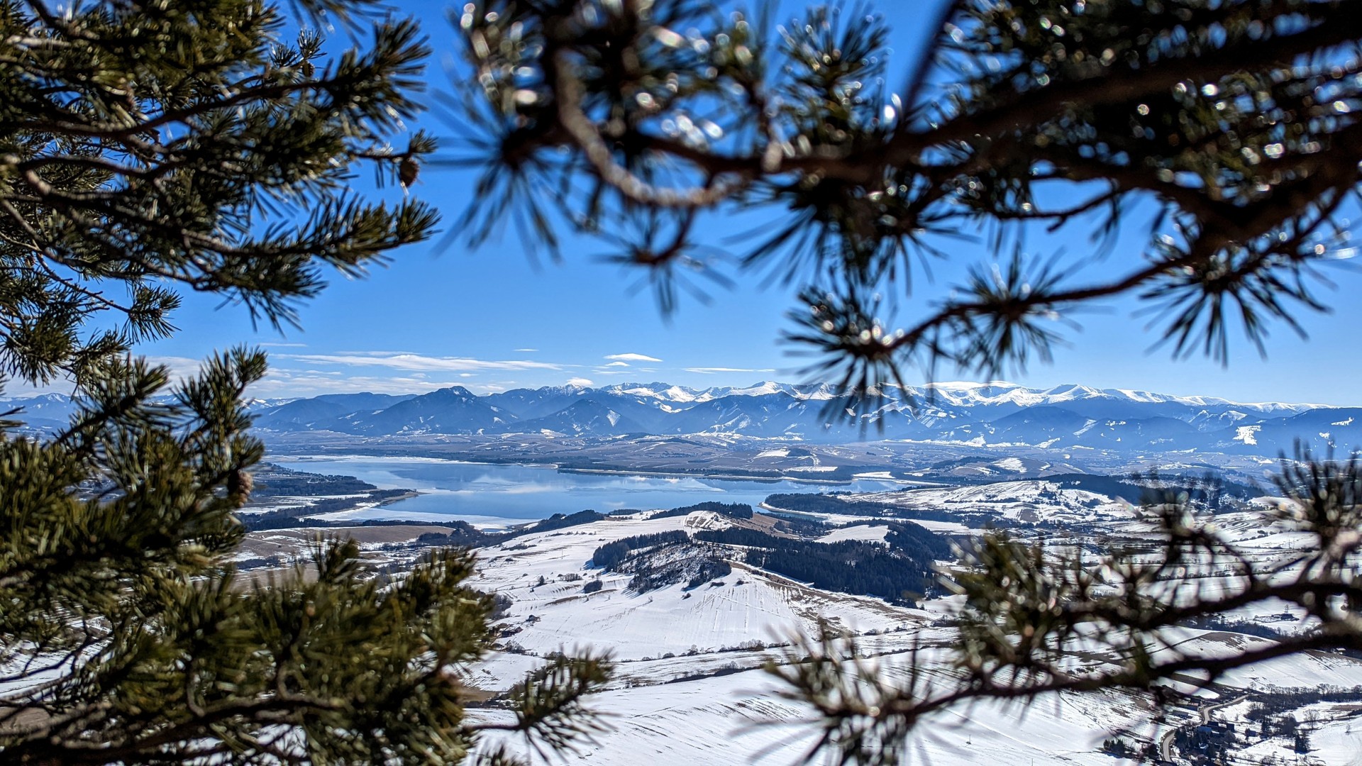
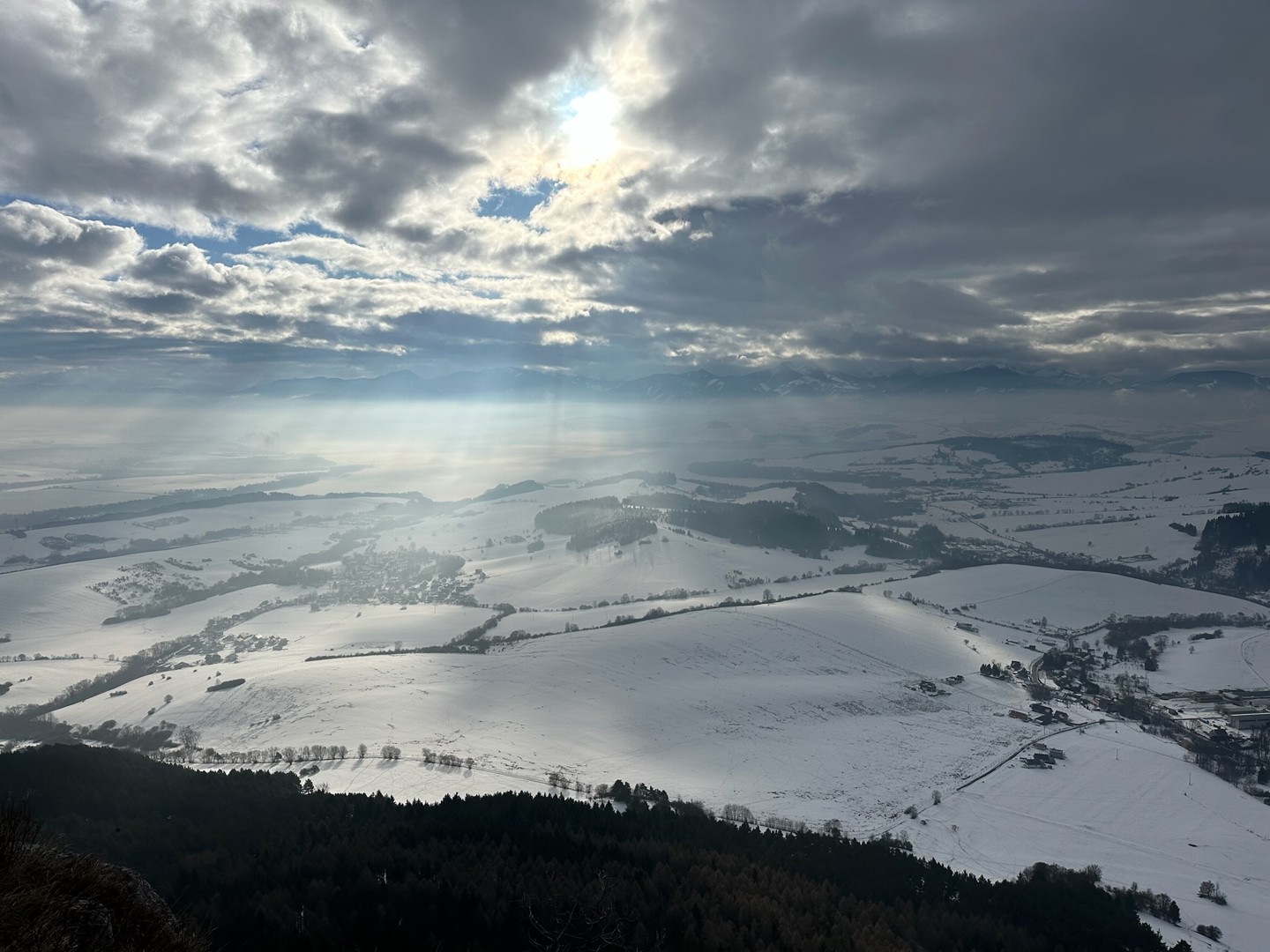
This time, from the correct slope, an inconspicuous path turns upwards. I check the map just in case, and we follow it. After the downpour the night before, the clay surface is a little slippery. After a while, another joins from the right and, to my surprise, there is a red mark on a tree. I don’t know where the route starts, but this explains why the trail is so well trodden. It should be added that it is relatively steep. We are sometimes offered a view of Liptovská Mara through the trees. The ascent is strenuous but I enjoy it immensely because the forest smells of the night’s rain and the greenery is breathtaking – after all, we are in Liptov in mid-July!
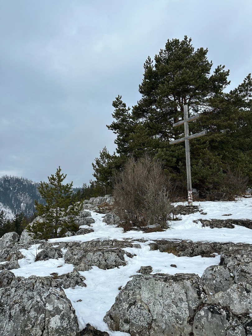
We steadily climb, pass a distinctive rubble field and then an impressive rocky cliff appears overhead. I explore this intriguing wall but don’t see any pitons or ropes anywhere – perhaps nobody climbs here. A cross appears above, and the heated rock really resembles a table, or rather it creates a very comfortable bench, ideal for a picnic. The end of the red trail is marked on the rock, but there is no signpost anywhere. While we are rooting through our backpacks for food, I am haunted by the thought of the inconspicuous path that continued further into the Čerenová massif before the turn to the rock terrace. On the one hand, I am not excited by the idea of descending the same path, and on the other, I feel like a bit of improvisation. On the digital map, I find an unmarked but distinct trail that runs along the hillside and only slightly crosses the contour lines.
Hunting trail under Čerenová and Lomné
I hear thunder somewhere above Veľký Choč and the weather forecast says there is a threat of occasional showers and storms, but this one will miss us. I continue along an inconspicuous path from the saddle behind the rock. It climbs steeply at first, so I start harbouring doubts, but then turns to the left and follows the contour line as it should. The map wasn’t lying. This trail is like something out of the most secret dreams of a tourist!
It is not entirely clear to me how it originated, but I assume it was used by hunters or gamekeepers in ancient times. In some places they have employed pickaxes and shovels, while in others it is quite inconspicuous, created only by the walkers’ feet and overgrown with juicy grass. It steadily climbs, yet the slope is mostly pleasant and the wilderness is pure heaven.
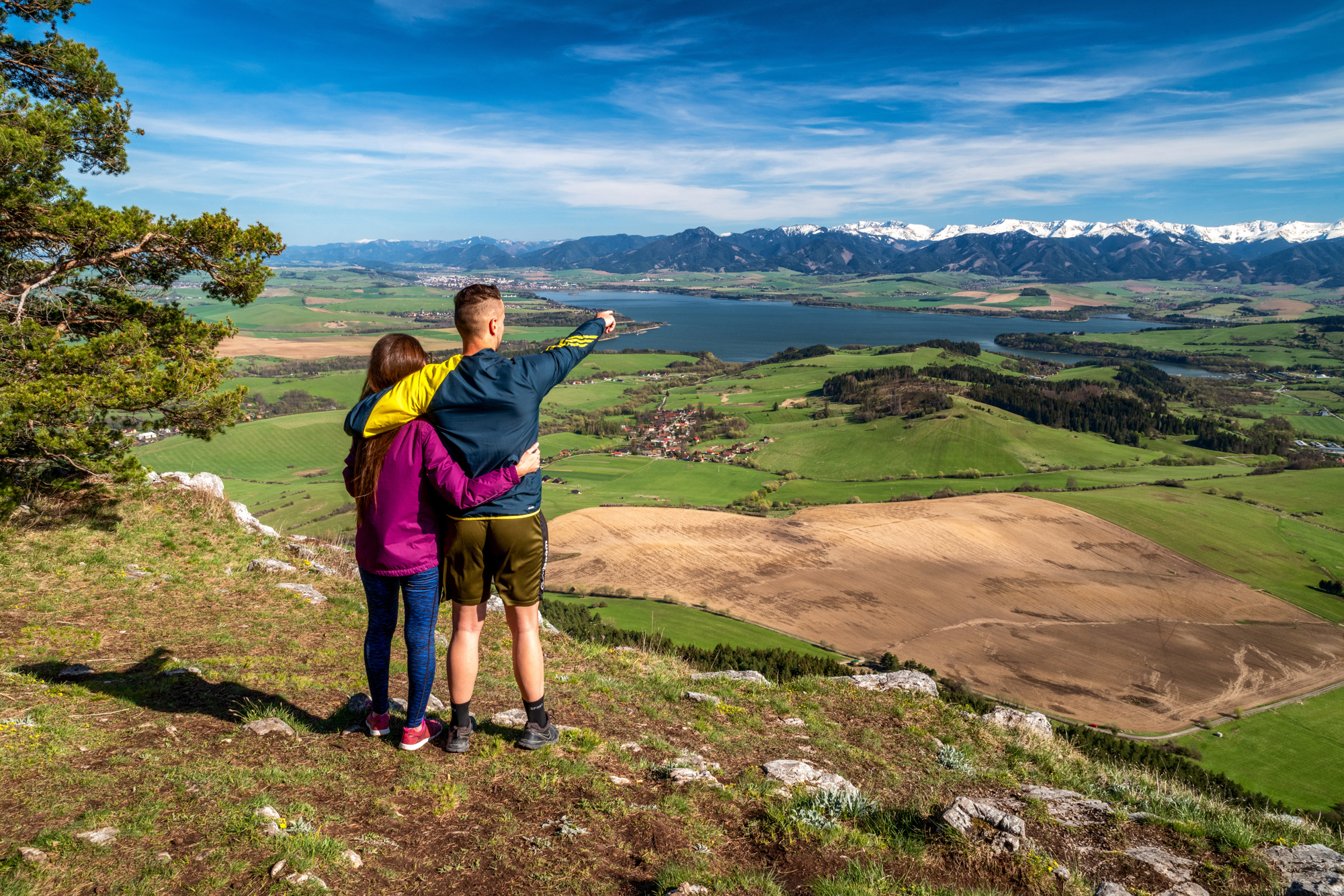
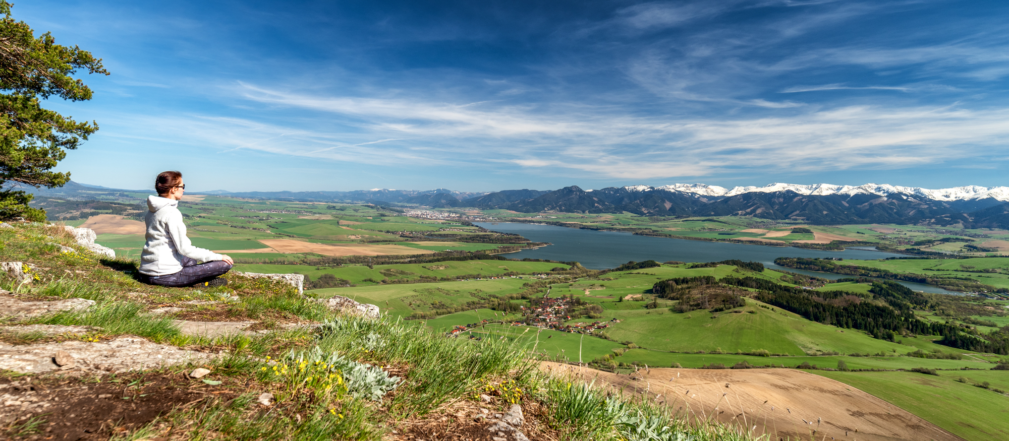
Several sections lead directly above rock walls, so the route requires some concentration. I probably wouldn’t take small children here, as the chasms under our feet sometimes take our breath away. I whistle and sing because this is the perfect place to meet a bear. According to the head of one national park (a bear expert), they like to hang around hunting trails because this means they can move around without using too much energy and they are not disturbed as often as on marked hiking trails. Those prints in the clay I see are just deer, but we don’t want to take risks, especially where we cannot see around the corner, and so we make loud noises to make sure we don’t surprise anything. I check our progress on the map from time to time and we are making decent progress. At one point we see Veľký Choč through the trees and over the neighbouring ridge. Here and there the surface of the narrow path is clay, at other times needles and roots, often grass and occasionally gravel. When we are below the peak of Lomné, the trees part and we see into a clearing revealing the impressive amphitheatre at the end of the Annina dolina valley. Clouds are gathering just over the ridge, along which the green hiking trail runs.
Biblical rain
We rush through the clearing, but here the terrain is the most treacherous. The vegetation rises above our knees and in places even up to our armpits, and the tall grass conceals branches left after logging, stones and other hazards. We are continuously searching for the trail as it keeps disappearing, but a little further ahead I see a clear line that will lead us to the saddle of Rovne between Lomné and Heliaš. We have mostly been heading north so far, but here we change direction towards the west and I have to say the sky looks slightly apocalyptic. It darkens and the rain arrives almost like an advancing wall. We shrug off our backpacks and put on our waterproofs. As expected, we link up with the green trail and normally we would follow it to Pravnáč and the car, but in this downpour we just look for the shortest way to the valley.
The forest path turns into a stream of dirty water, but in the end the downpour does not last even half an hour. At its narrowest point, the path is cut into the rock, over which water pours. Our wet things are steaming. Purple bear droppings on the road confirm that we were right to be cautious – clearly blueberries were on his menu.
Before long, the world is once again bathed in summer sunlight, as if the whole downpour were just a dream, leaving behind only fragrant air. I look towards the slope of Čerenová and realize that our route has led us over white rocks that rise in many places along the steep slope. Only a few hours ago, I had no idea about the existence of this amazing trail down the mountainside, and it was only some strange coincidence that gave us the opportunity to get acquainted with this creation in the unforgettable nature of Liptov, previously unknown to us. There are doubtlessly more such hidden treasures of inconspicuous unmarked trails, and perhaps we will get to see more of them (www.hiking.sk).
Starting point: 49.150079, 19.467067
Free parking is available in the village.
By train or bus to L. Mikuláš and then by bus from L. Mikuláš to the village of L. Anna. – timetable.
In the village of Liptovská Anna there are only a few accommodation facilities and these are quite small (private accommodation). We recommend staying in nearby villages, such as Bobrovník, Liptovská Sielnica, Potok, or Bešeňová. Food is available in both summer and winter in the surrounding villages in hotel restaurants, guest houses or huts.