Home Cross-country skiing From the village Pribylina to the begining of the valley Úzka dolina

From the village Pribylina to the begining of the valley Úzka dolina

Type: Cross-country ski trail
Difficulty: 2 - easy
Route length 3.5 km
Climb: 119 m
Sinking: 2 m
Duration 0.75 h
Lowest point: 778 m
Highest point: 894 m
View elevation profile:

Detailed route description:

Area:

Západné Tatry

Starting point

Pribylina

Navigate
End of route:

Úzka dolina

Navigate

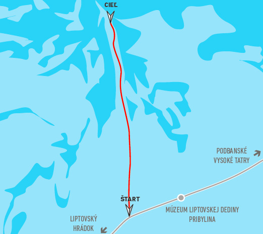
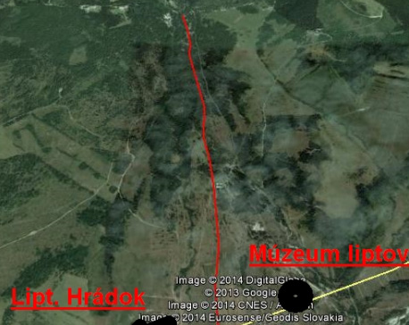
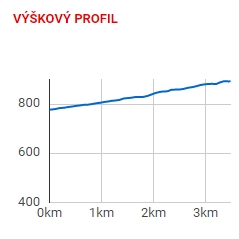
The track is the junction of the valley Úzka dolina with the village Pribylina. Parking is possible on the marked places in the village, near the open-air museum or at the end of the road in the parking lot below the valley Račkova dolina.

The project is implemented with the financial support of the Ministry of Transport and Construction of the Slovak Republic.

Liptov planner