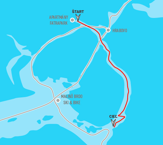
This circuit is often used by cross-country skiers. It has the length of about 1.5 km, from ski center Hrabovo to Malinô Brdo. You can also use the forest road under the cable car with the exit to Suché Hrabovo. From Suché Hrabovo you can continue towards the UNESCO monument the village Vlkolínec or by the “royal” road towards Smrekovica massif. This alternative is especially suitable for more skilled skiers and offers beautiful views from the Big Fatra main ridge of the surrounding mountains.


The project is implemented with the financial support of the Ministry of Transport and Construction of the Slovak Republic.