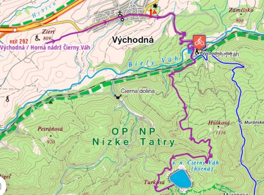
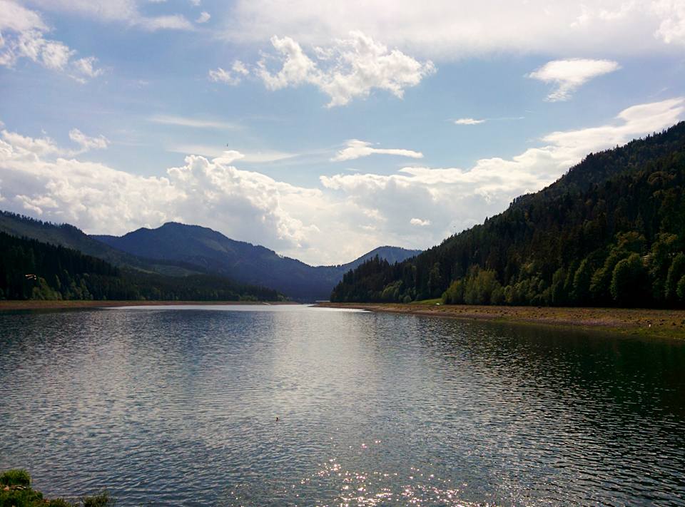


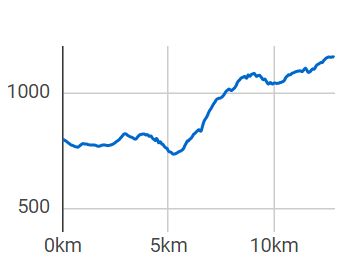
Starting from the village of Východná, the route will take you past the amphitheatre to the ponds. Walk through the underpass under the railway, from where you follow the forest foopath that first runs alongside the railway track, later turns left and starts climbing gently. The path will lead you along several raised hides, where you can pause in the evening and – with a bit of luck and patience and enough time – you might see forest animals. The route starts climbing more steeply and it snakes through the woods before it brings you to an asphalt road. This is where you turn left and continue ascending to the water reservoir, where you will be rewarded with spectacular views over the whole Liptov. In the distance you will see Chočské vrchy mountain range, on your left there will be the Low Tatras and on your right the Western Tatras and the High Tatras.
You can park in the Východná village. The village is also accessible by bus or train.
There are various accommodation and dining options in the village of Východná.