ROUTE:
Kvačany – Liptovské Matiašovce – Bobrovecká Vápenica – Tokariny – Žiarska dolina – Ústie Bystrej doliny – Podbanské
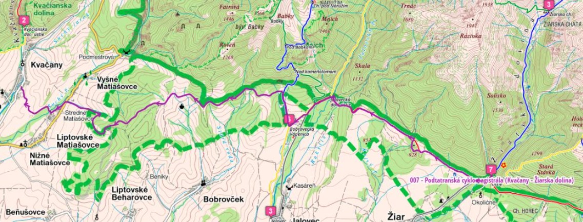
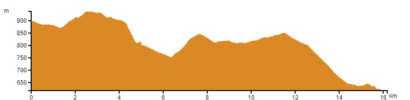
We start the trail in the village of Kvačany at the crossroads with the Oravská cyklomagistrála. Then we go to the village of Liptovské Matiašovce, from where we continue with a good forest path and slowly start to climb over the village of Upper Liptov. From the route there are beautiful views of Liptov and Tatra peaks.
Gradually, the route comes to Bobrovec to Bobrovecká Vápenica, where it crosses the green cycling route and leads to the Tokarina locality, where the cycling route continues to the right and passes through the stream at the entrance to Jalovecká dolina and continues under the Tatras. Another stop is the mouth of the Žiarska Valley, where three marked cycling routes cross.
Gradually, we go to the location of Usti Bystrej dolina where the route continues along forest paths under the Western Tatras. Finally, we get to Podbanské.
Parking is available at one of the car parks in the area from which you start the route. In the village of Kvačany or Podbanské.
The possibilities of accommodation and boarding are along the whole cycling routes in individual villages such as Kvačany, Liptovské Matiašovce, Bobrovec, Jalovec, Žiar or Podbanské. You can stay in smaller hotels, guesthouses or in private. Catering services are provided by restaurants or buffets.