Winter closure: the ski mountaineering season lasts 15.12 – 15.4.
Best time for the trip: all season with enough snow
Equipment: depends on the conditions, ski crampons are recommended, crampons – in case of icy conditions, avalanche equipment is necessary
Route description
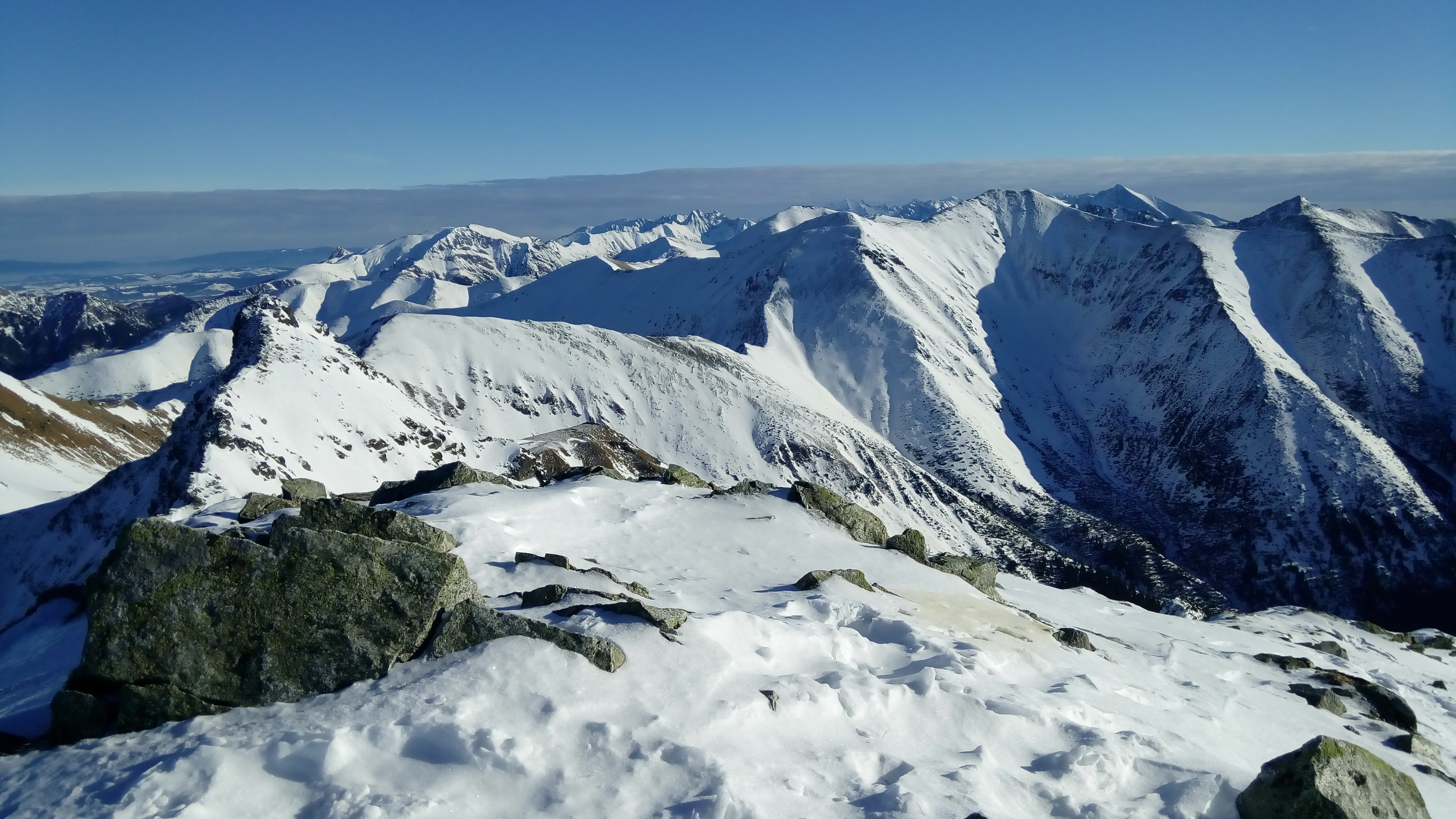
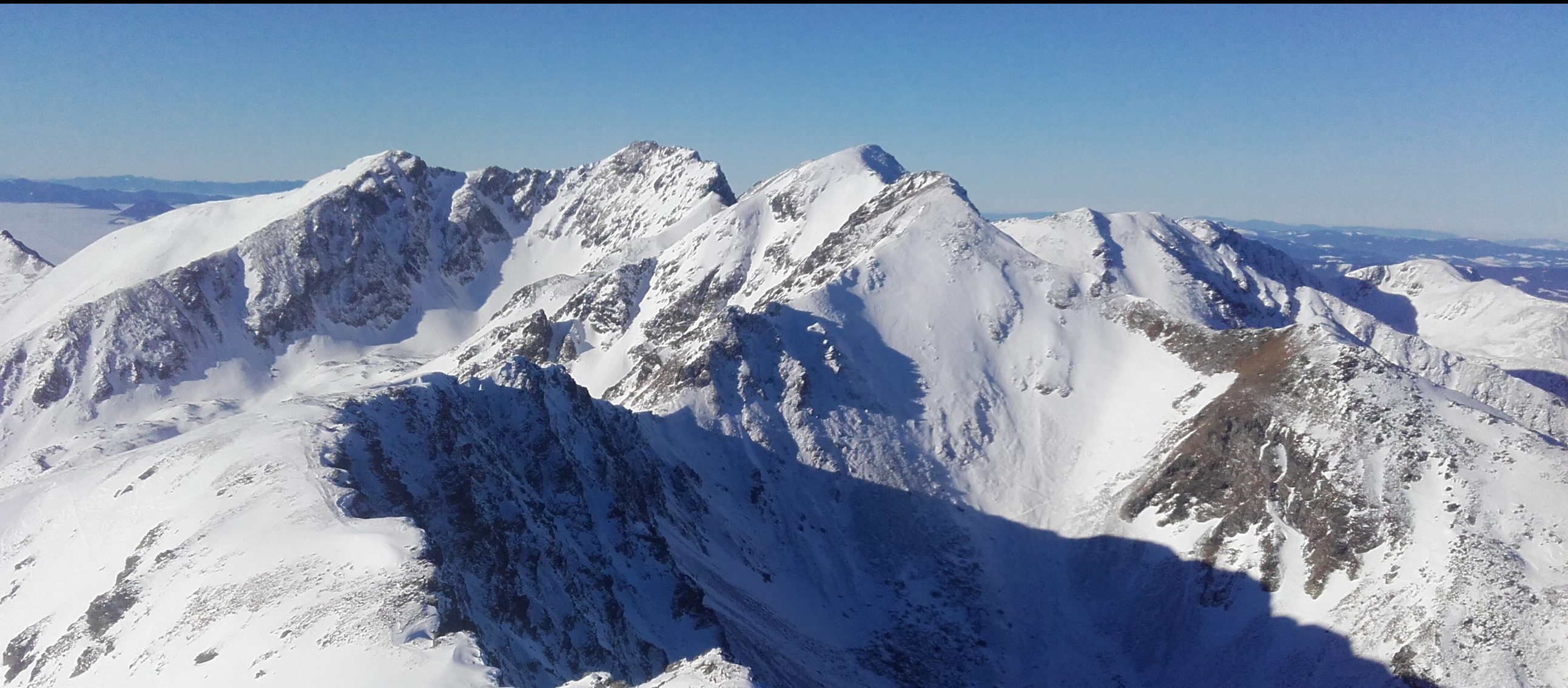
Plačlivé, also called Plačlivý Roháč, is a significant peak in the main ridge of the Western Tatras. It is a distinctive pyramid that can be seen from afar. Together with Ostrý Roháč peak, they form an iconic panorama, thanks to which this part of the Western Tatras is also called Roháče. It attracts with good accessibility from Žiarské sedlo and an excellent view. The whole route is located in free alpine terrain, thus it is not suitable for beginner ski mountaineers. Although the route is not one of the most endangered by avalanches, it is nevertheless necessary to follow the knowledge of avalanche issues and carry mandatory avalanche equipment all the time. The whole way up can be completed, during almost the entire season, on ski mountaineering skins. Ski mountaineering crampons are only needed exceptionally, under very adverse conditions (eg icy snow surface).
Way up
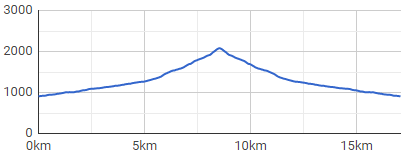
The route starts at the mouth of Žiarska valley (Žiarská dolina), right at the parking lot. The valley has an elevation of about 400 meters in 5 kilometres distance, It is sometimes ridden by a snowmobile, or has a ski track already made by other ski tourers.The route passes smoothly around Žiarská chata, which is an ideal stop for refreshments before the ascents gets more demanding (and steeper).
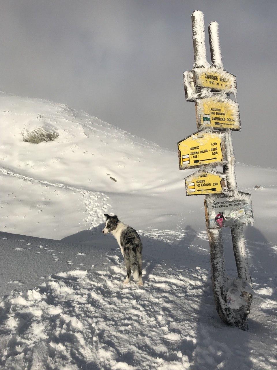
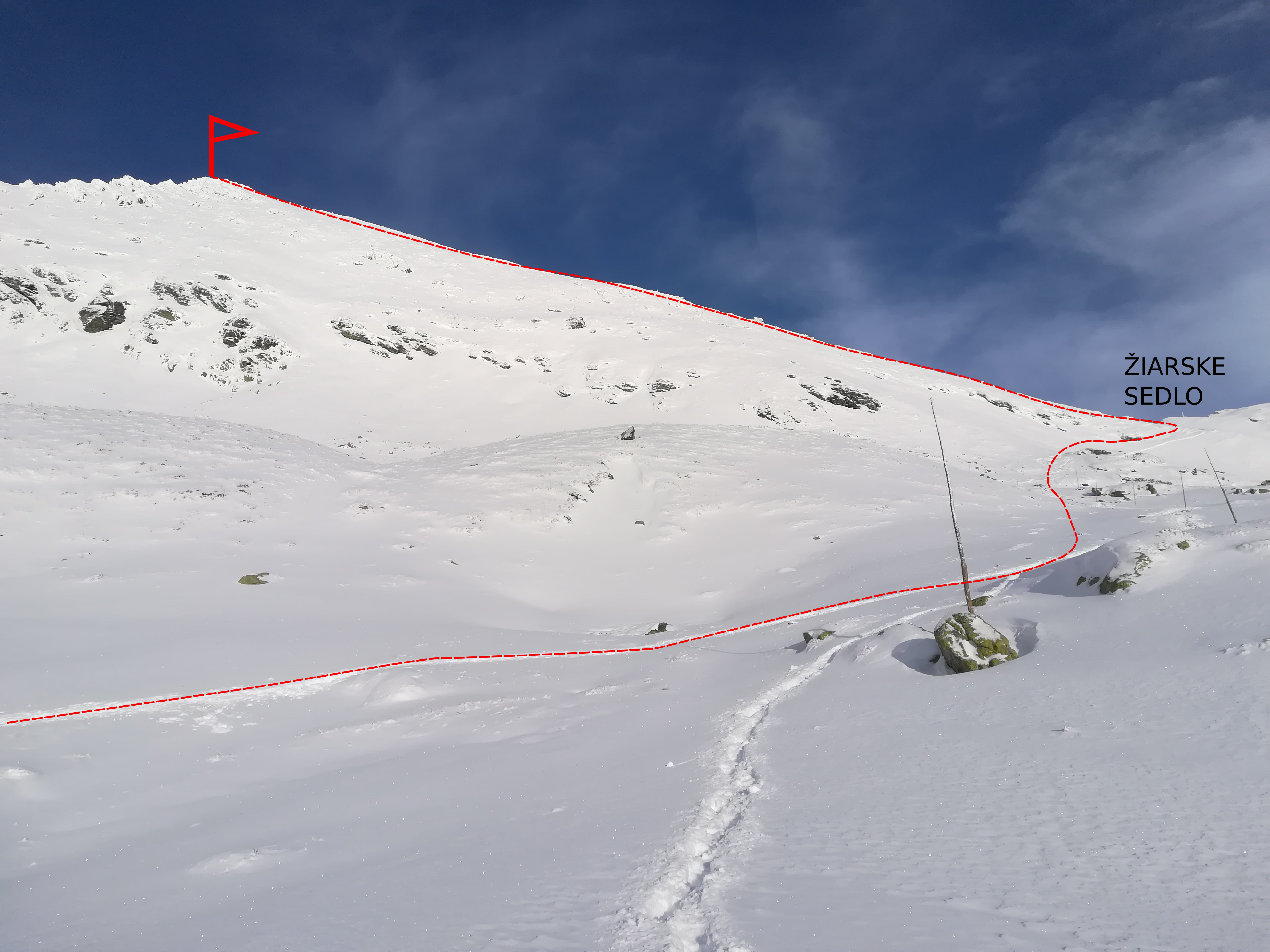
Above the cottage there is free open terrain, initially slight with a slope of up to 30°. The ascent route copies the summer marked trail and alternates steeper sections with milder ones. Initially, the route leads through the forest and knee timber trees, which gradually thin. With ascending height meters, the views of the whole valley and especially of Baranec, the highest peak in the whole valley, open up. As if within reach is the goal of the ascent – the top of Plačlivô. The way up continues around the crossroads below Homôľka. On the left, the summer path leads to Smutné sedlo (Smutné Saddle), on the right, the route continues to Žiarské sedlo (Žiarske Saddle).
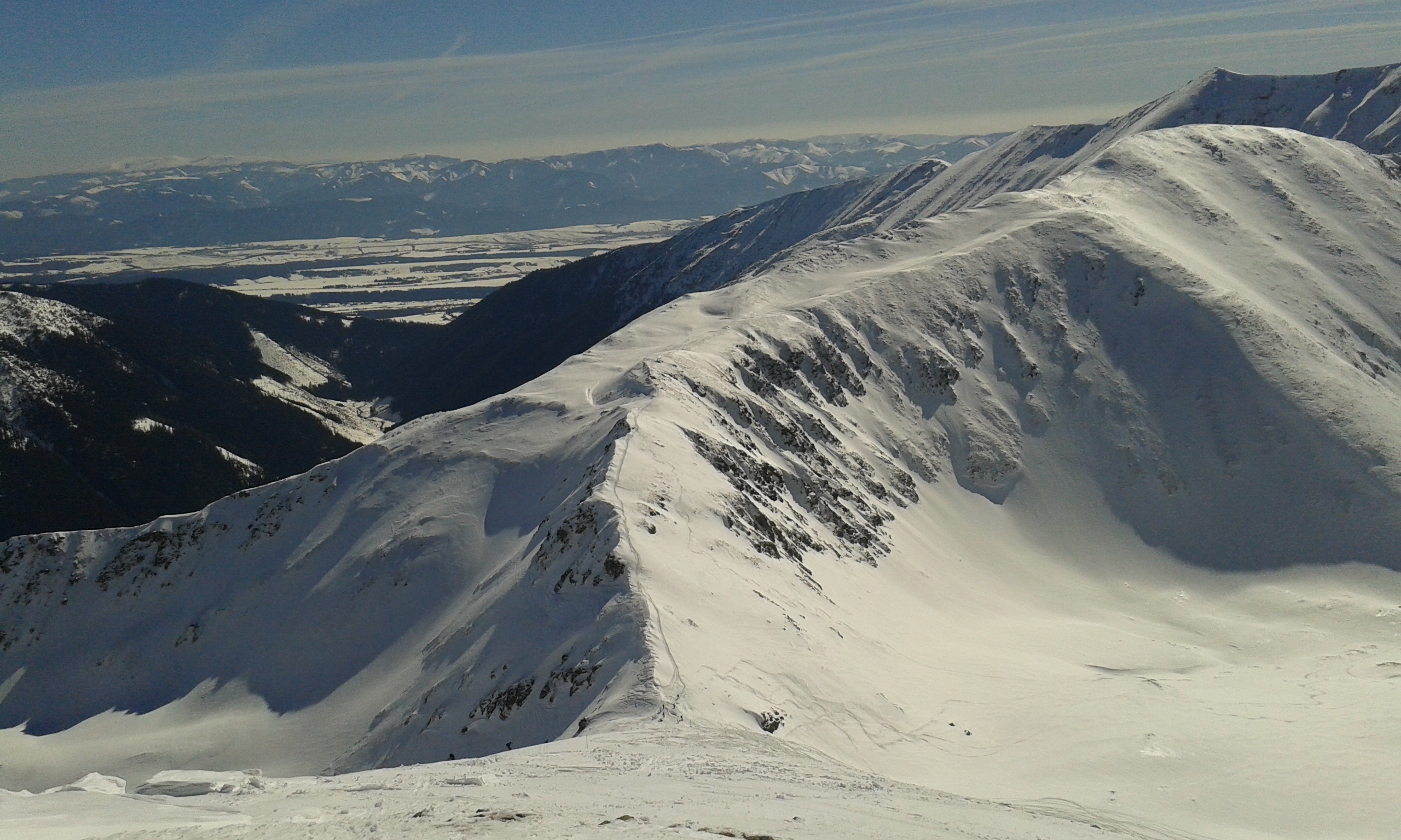
One more steep climb and there is Žiarske sedlo with a pleasant platform to rest before the last section leading to the top. The Saddle is 208 meters high from the top and about half an hour of steep hikes. During icy conditions, it is necessary to use ski crampons, or crampons and climbing axe. At the very top there is a compact view of the southern and northern side of the Western Tatras, with Liptov, Orava and Kriváň peak.
Way down
The slope is wide, with several descent routes interrupted by rocks. Beware of avalanche terrain, especially in the right part above the crossroads below Homôlka. The inclination is around 30 to 40° and there is less space for maneuvers in the upper part, but enough in the lower part. In milder winters, however, timber knee trees stick out out significantly in the lower part, so mind to be careful in this part, too.
Symbolic cemetery for the victims of the Western Tatras – the cemetery was created by the Mountain Rescue in the Western Tatras to the growing number of victims of mountain accidents over the last two decades and taking into account the efforts of survivors and friends to place memorial symbols in places of accidents.
Medvedia štôlňa tunnel – is the longest tunnel in the Massif of the Western Tatras and at the same time the only accessible old mining spot in Liptov. The underground spaces reveal the secrets of mining work, the methods of transporting mining material and the obstacles that miners encountered while working.
By bus: there is a stop in the valley, but the buses come only occasionally
By car: large-capacity, unguarded, paid parking lot with toilet, right at the beginning of the route
Žiarska chata – there is a hut’s kitchen and a cantine with a rich offer of drinks and meals. Please note that card payment is not possible.
Žiarska chata – we recommend booking accommodation in advance due to the popularity and availability of the hut. Weekends are often booked months in advance.
In the vicinity of the parking lot there are several other facilities that also offer restaurant and accommodation services – Hotel Spojár, Salaš Žiar, hut Kožiar, hut Třinec.
+
full alpine hike
views of Liptov and Orava
infrastructure: parking, mountain hut
good snow conditions almost throughout the season
–
poor bus connections
the lower part of the route is richly visited by tourists and pedestrians (traffic)