Season: ski touring season is between December 15 and April 30
Ideal conditions are between December and April
Necessary equipment: avalanche safety gear, crampons and an ice axe
Chopok is the third highest peak of the Low Tatras. The route leading to its summit is ideal for skiers who seek to enjoy the off-piste terrain and want to use the facilities built in the Demänovská Valley (chalets, buffets, parking spaces) at the same time. The advantage of this tour is the fact that you can check actual snow conditions and avalanche forecasts during the ascent, before you start skiing down the steep draws.
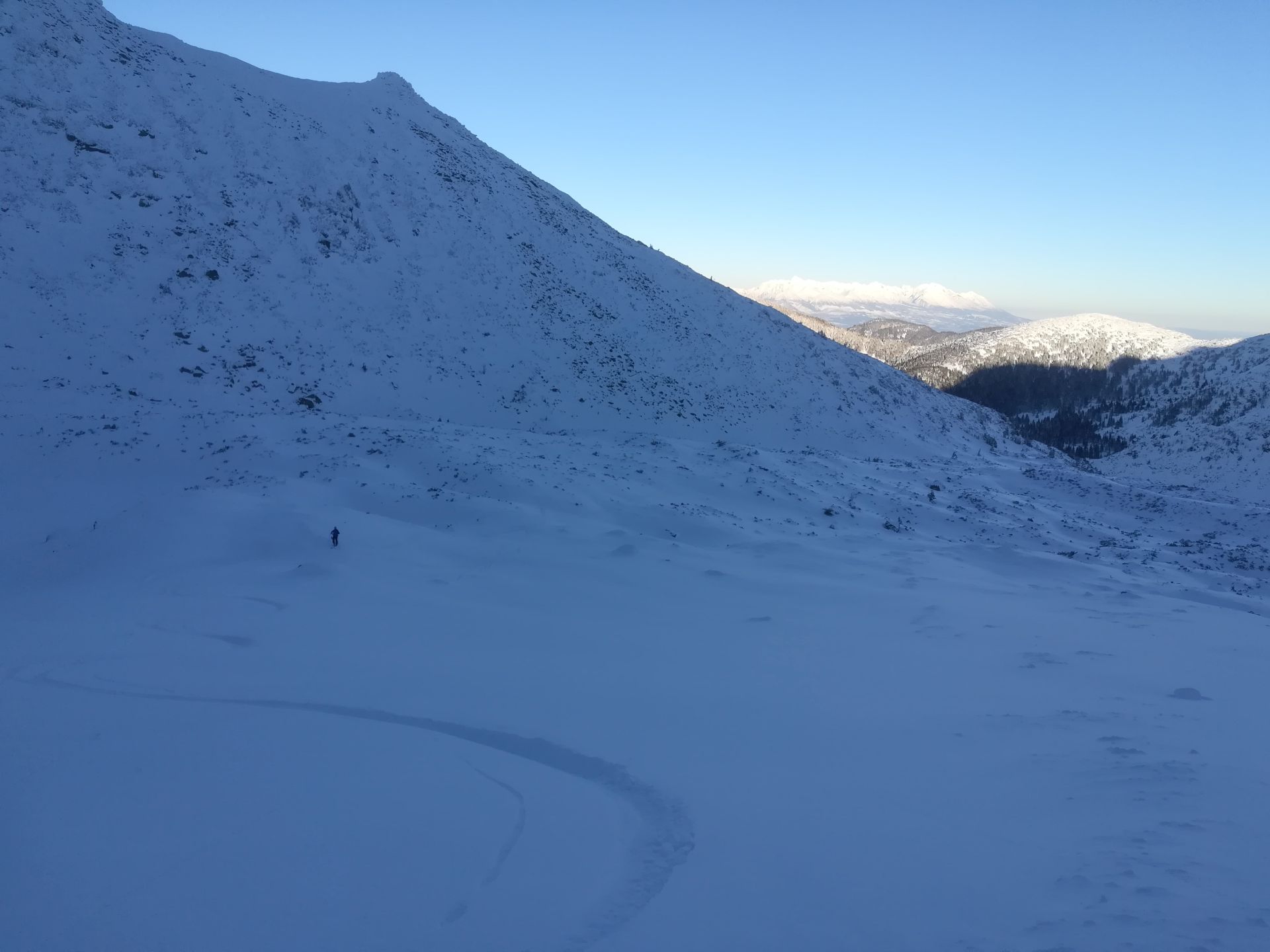
Since the part of the trail leads across one draw, you will need to know how to use crampons and an ice axe if the snow surface is hard. Even though the trail is on the northern part of the mountain range, the sun shines here mainly early in the morning when the sky is clear. This is because the whole Lukovský Kotol opens towards the east. The snow conditions here are normally better than in the adjacent Derešský Kotol because there are snowfalls even in north-westerly winds. This is an advantage on one hand, but on the other hand, such wind currents can form dangerous snow cornices and ledges. The steepness of the terrain, mainly in the draws, makes it necessary to check actual snow and avalanche conditions at www.hzs.sk.
In addition to avalanche forecasts, we recommend watching the movement of other people on the spot as this area is sought after by free-riders, who have an easy access thanks to the cable car that takes them up to Chopok.
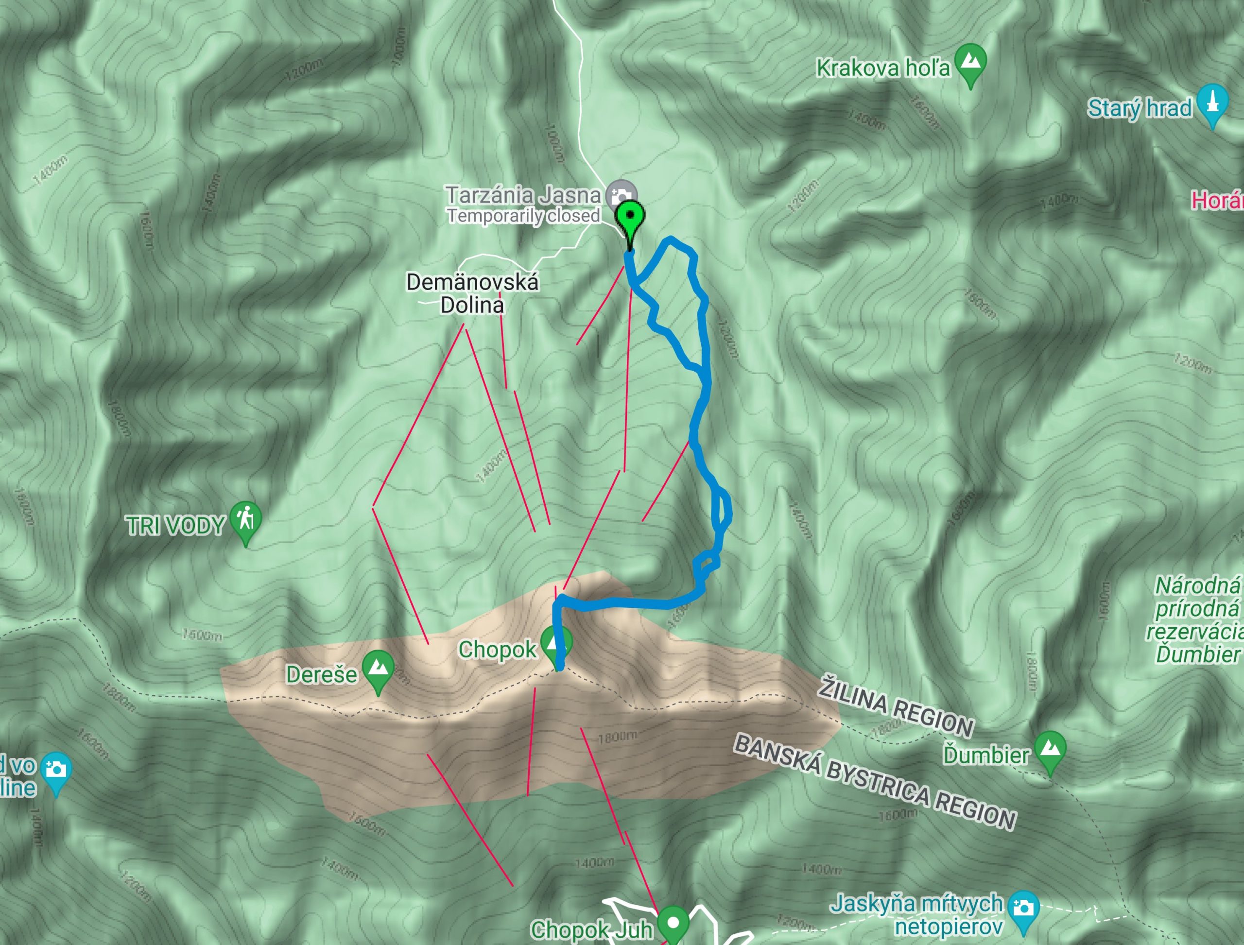
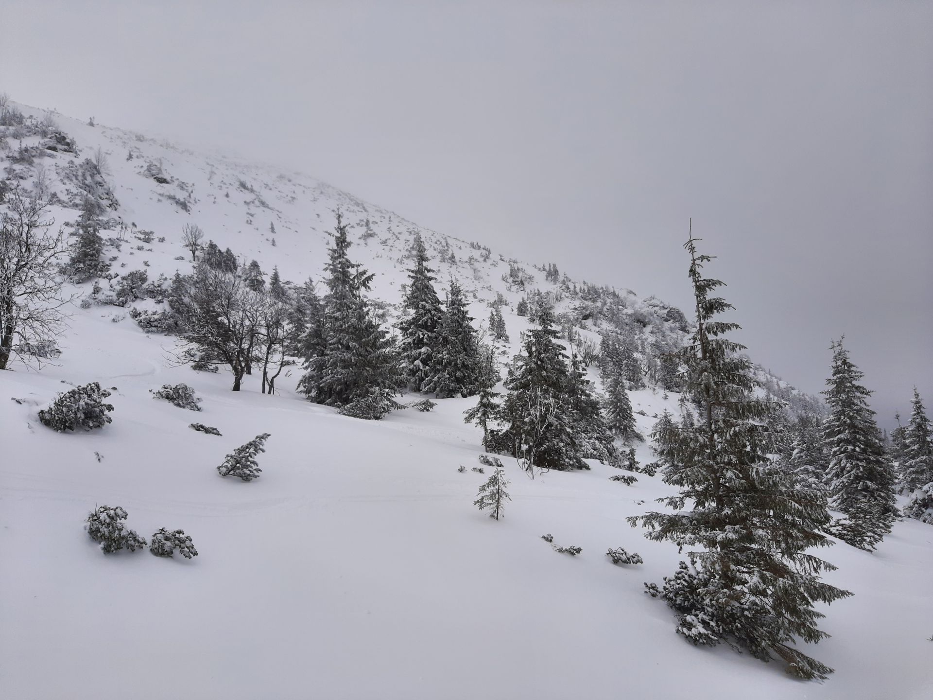
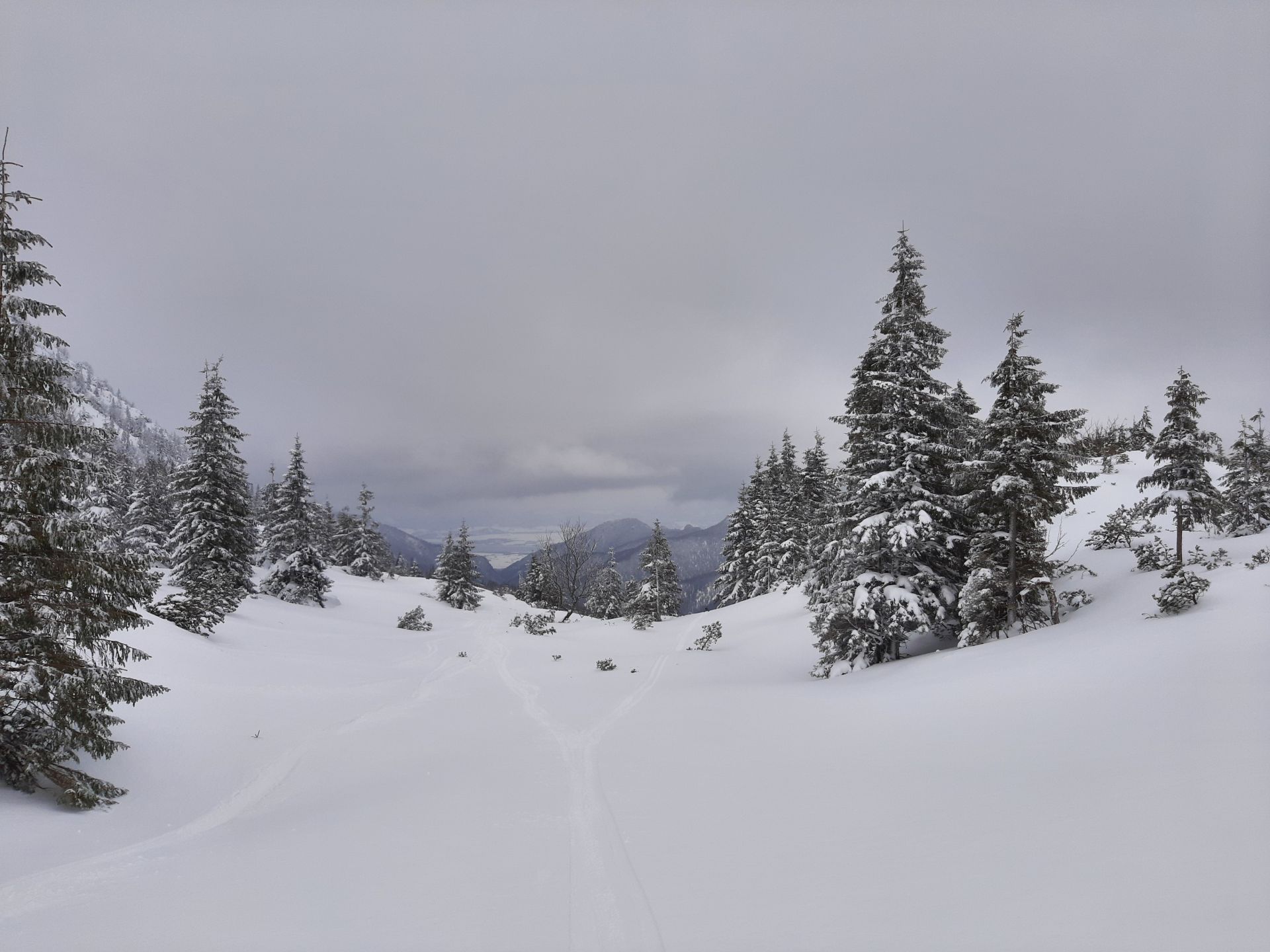
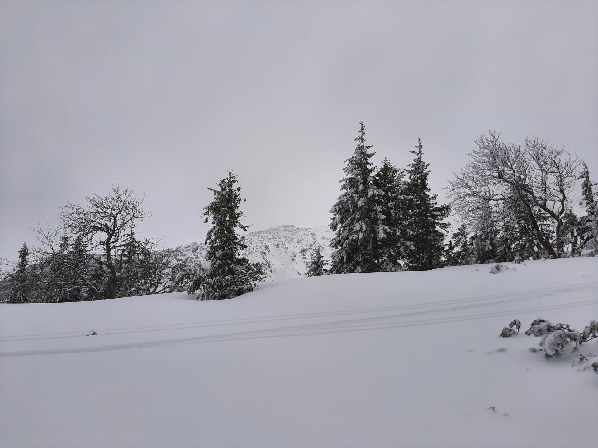
The tour begins in the mountain resort called Jasná – Záhradky. The first few kilometres lead along the ski run named Turistická. When moving along the ski slopes, you should be lined up one behind the other (not next to each other) and respect other skiers on the piste. At the hiking crossroads called “Pekná Vyhliadka”, the route continues along the red marked hiking trail. After 600 metres, however, you will need to turn right and continue past the fallen trees towards Lukovský Kotol.
You can often see ski paths that will show you the right direction. However, this place is the most difficult when it comes to orientation. Later on, you will spot the draws of Konský Grúň on the right, which are also very popular with skiers.
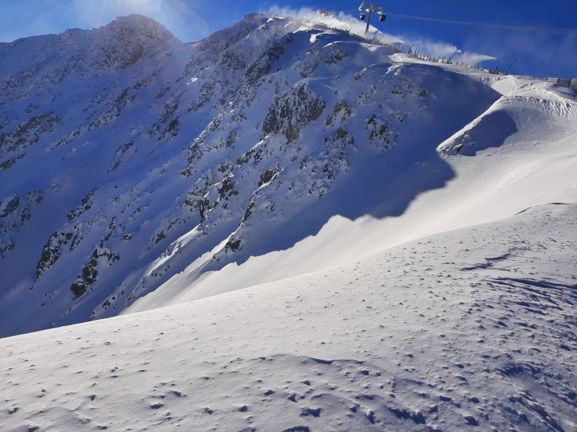
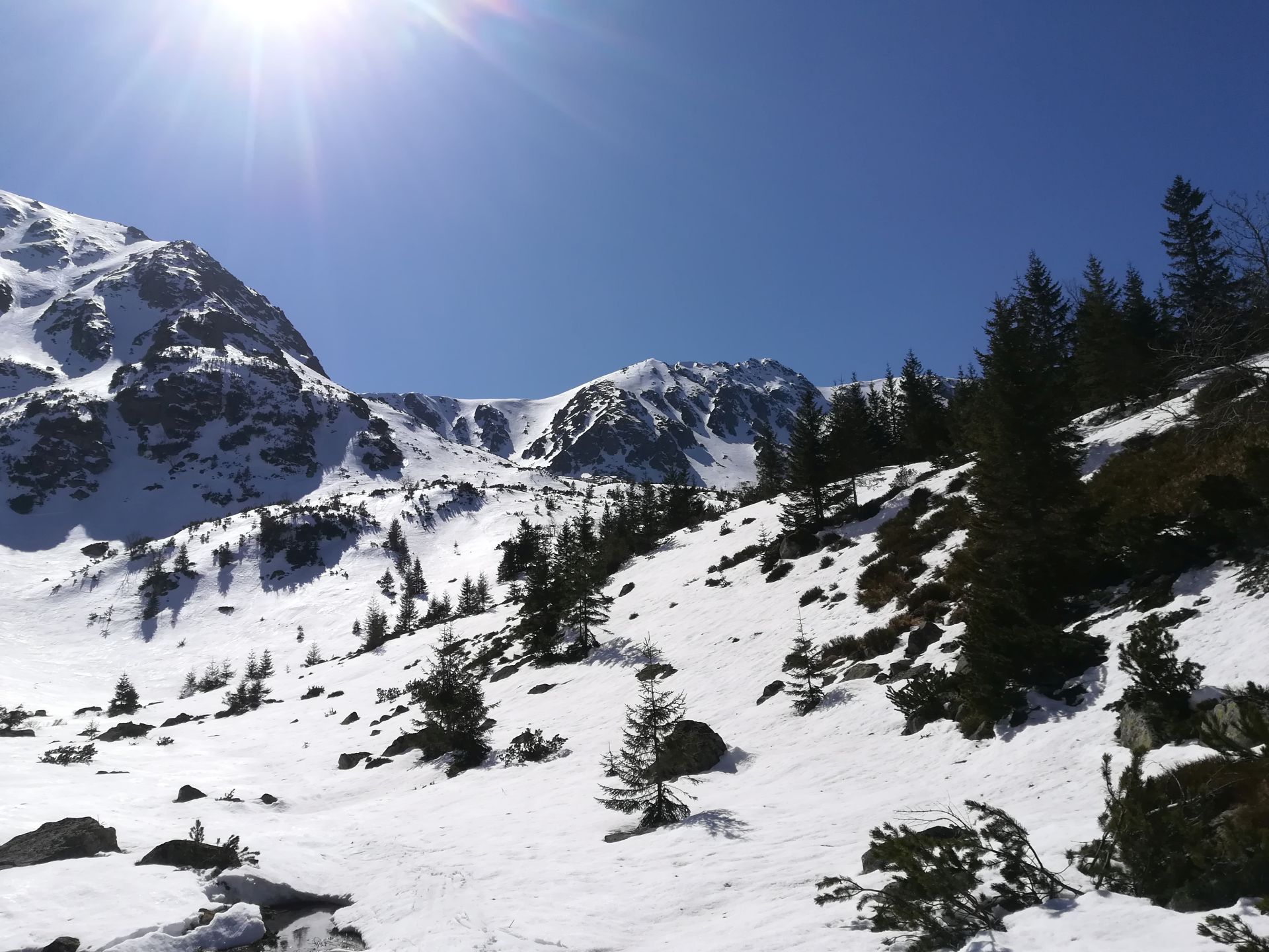
The tour continues above the forest vegetation zone, where you can enjoy the views of the whole Lukovský Kotol and the summit of Chopok. On this spot, you have several options how to move on. The straight route leads up the draw called Meteorologický Žľab, which is, however, quite long, narrow and steep. The so-called Školský Žľab is the most recommended as it is the widest, the shortest and the most moderate of all. As a result, you will avoid collisions with other skiers. What is more, the less steep the slope is, the lower the risk of avalanche is. Nevertheless, we still recommend watching avalanche forecasts as there is a risk of avalanches even in this place. When you ascend the draw, there will be about 200 metres of elevation gain ahead of you as you climb up the ski run to the summit of Chopok. Before you start your descent, take a rest and get a little refreshment at the chalet called Kamenná Chata, which is very popular with hikers and skiers. You can also walk up to the summit of Chopok (2,024 m.a.s.l.), which, however, is not suitable for descents as there are huge stone blocks on its slopes.
When it comes to descents, there are several options. Less advanced skiers can ski down the pistes. Those who prefer off-piste skiing can descend the draws, which belong to the freeriding zone, but only under safe weather conditions.
Meteorologický Žľab
This is a north facing draw. As a result, the sun almost never shines there and the snow surface is much harder compared to the east facing draws. Its steepness and length require advanced ski-touring techniques. Following the weather and avalanche forecasts is important as well.
Školský Žľab
This east facing draw catches the early morning sun. When it comes to descent, it is the widest, the shortest and the most moderate draw and, therefore, it is called Školský (school). Even though it is the easiest draw to descend, there is still a risk of avalanches that should be considered.
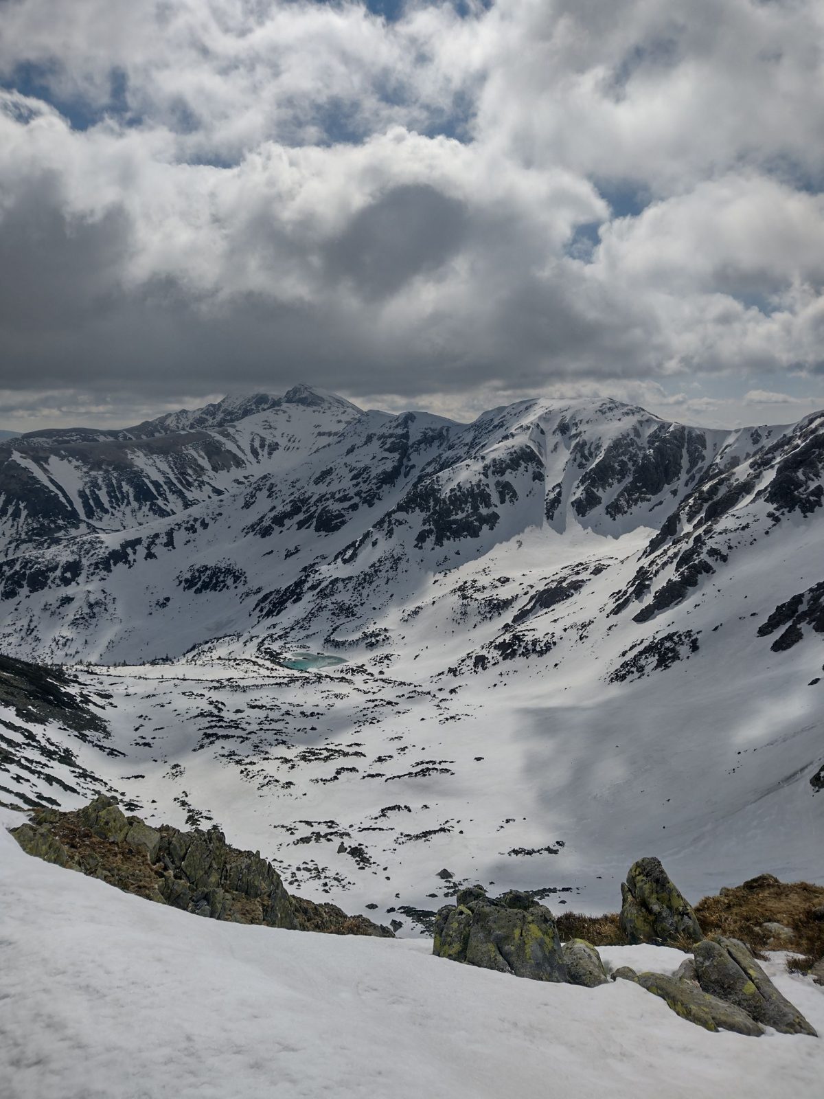
There is a small picturesque lake at the bottom of Lukovský Kotol, especially in spring when the snow starts to melt.
By bus: the Demänovská Dolina bus stop, the ski bus will take you to the Záhradky bus stop
By car: paid parking lots with limited capacity right at the beginning of the route. During the peak season, we recommend you to get up earlier so that you avoid traffic jams and find a parking place.
Kamenná chata, restaurant Rotunda
There is a diverse range of accommodation available, including the nearest hotels Liptov, Grand and Marmot as well as Koliba Jasná, Mikulášska Chata and the facilities in Demänovská Dolina and the city of Liptovský Mikuláš.
+
there is snow until late spring
you can get to the ridge in a relatively short time
infrastructure
–
in wintertime, avalanches may occur in the draws as the north-westerly winds blow in enough snow