
Winter closure: the ski mountaineering season lasts 15.12 – 15.4.
Best time for the trip: all season with enough snow
Equipment: depends on the conditions, ski crampons are recommended, crampons – in case of icy conditions, avalanche equipment is necessary
Route description
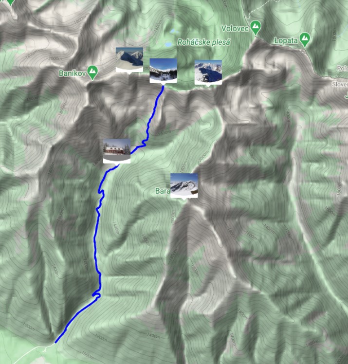
The goal is a distinctive saddle between peaks Tri kopy and Plačlivô on the main ridge of the Western Tatras. The Saddle connects the closed Smutná dolina (Smutná valley) in the winter with the Žiarská dolina (Žiarská valley). It is one of the most classic tours in the Western Tatras. However, it leads in rugged open terrain, so it is not suitable for less experienced skiers or beginners (especially in the case of icy conditions).
Way up
The whole way up can be completed, during almost the entire season, on ski mountaineering skins. Ski mountaineering crampons are only needed exceptionally, under very adverse conditions (eg icy snow surface).
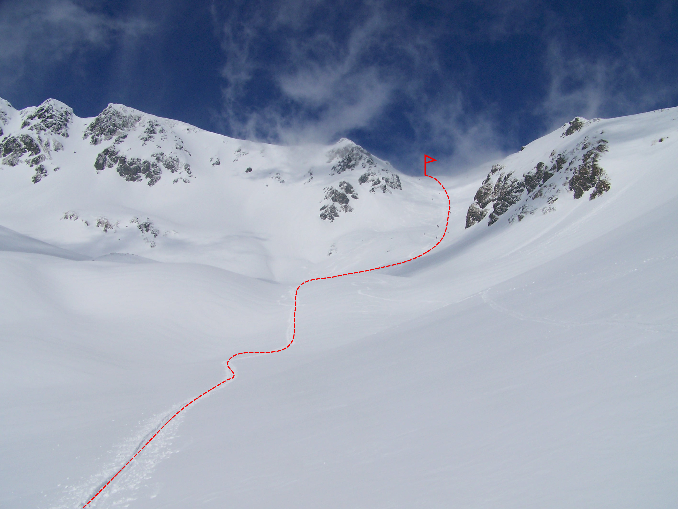
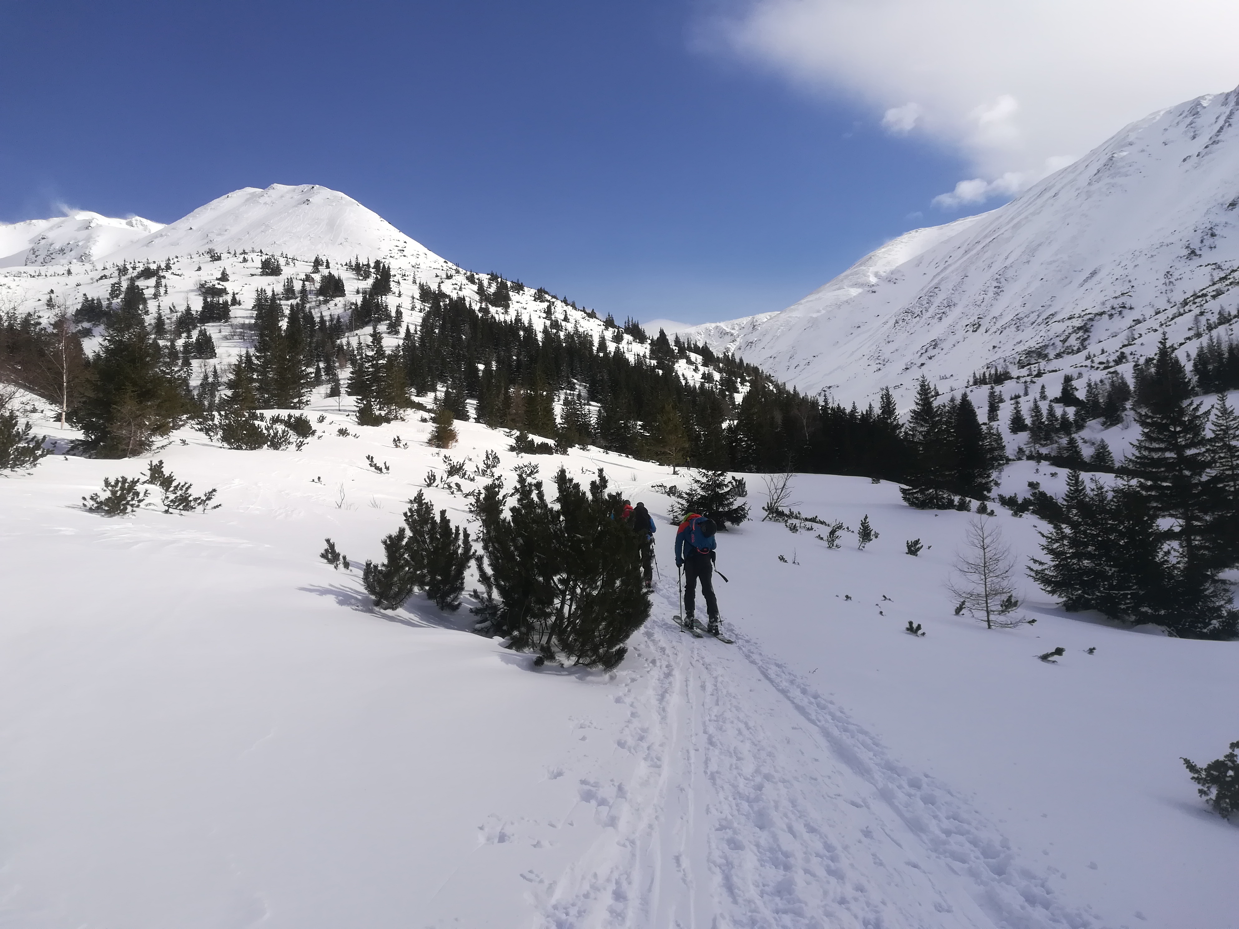
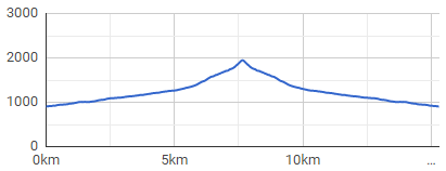
The route starts at the mouth of Žiarska valley (Žiarská dolina), right at the parking lot. The valley has an elevation of about 400 meters in 5 kilometres distance, It is sometimes ridden by a snowmobile, or has a ski track already made by other ski tourers.The route passes smoothly around Žiarská chata, which is an ideal stop for refreshments before the ascents gets more demanding (and steeper). Above the cottage there is already free terrain, initially slight with a slope of up to 30 °. The key place in terms of navigation is in the woods, about 500 meters away from the cottage. Here, the road divides in the direction to the left into the area of Veľké Závraty, where there is also Smutné sedlo, and in the direction to the right to Malé Závraty (Plačlivé and Žiarske sedlo).
! It is important to keep in mind that the winter road does not copy the summer route to Smutné sedlo. The mentioned crossroads is followed by a steep section between low trees and knee timber. This section is often slippery, hard, with bumps, and sometimes it is necessary to use ski crampons at this point. It is also narrow, and therefore it is necessary to pay attention to skiers who had chosen to start earlier and are already returning downwards.
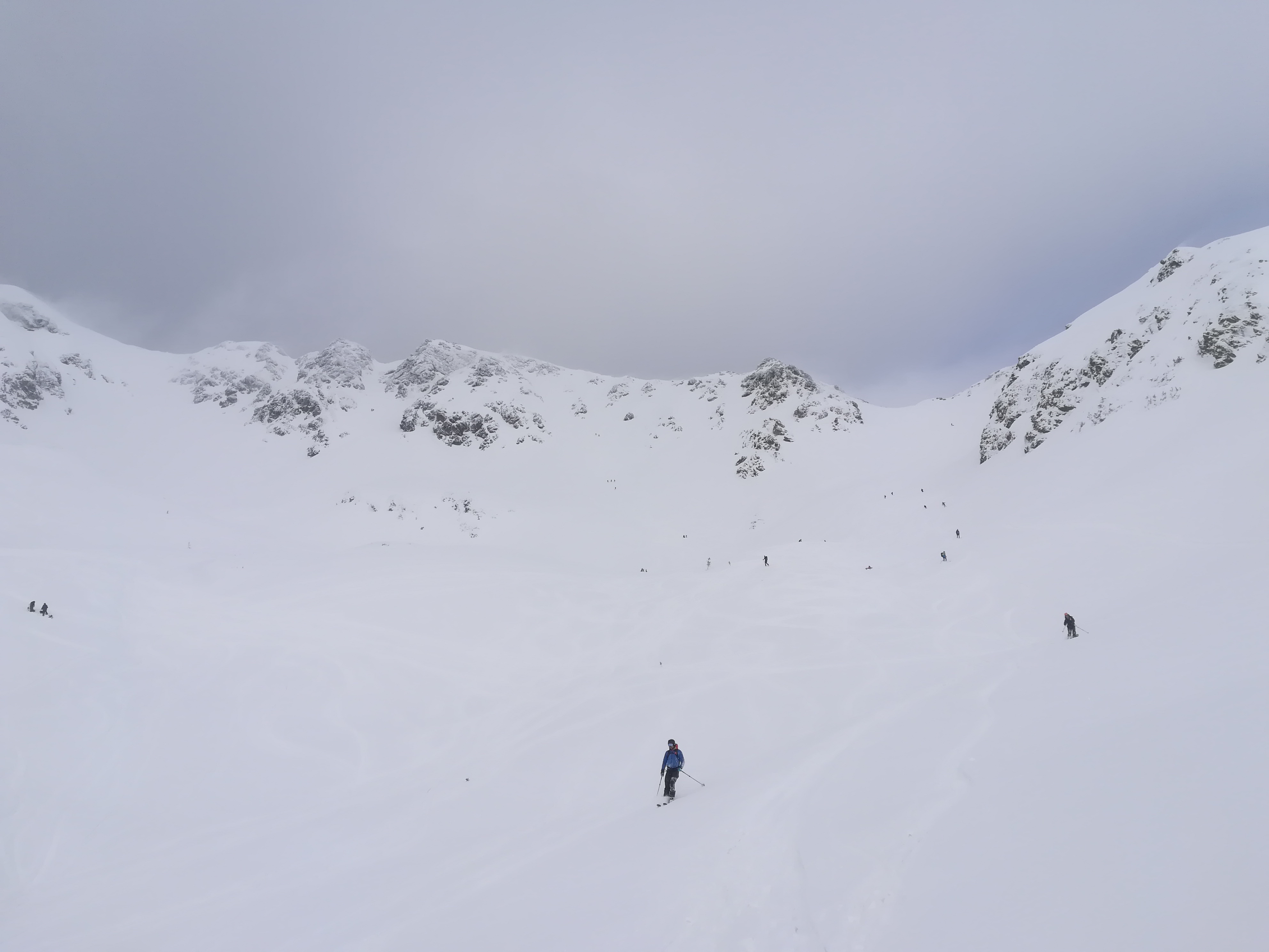
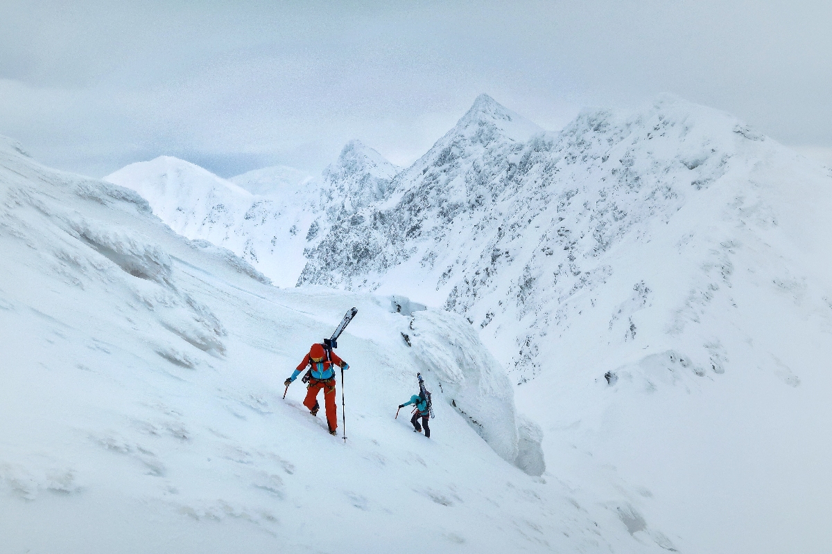
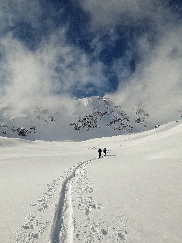
The terrain subsided after about another 500 meters and the route leads through the so-called Terrace below the Smutné Saddle itself. From this place there is already a very good view of the whole of Velké Závraty, Baníkov, Tri kopy and the end point of the route – Smutné sedlo. Just above the Terrace there is an area challenged by avalanches begins. The right side, where the steep slopes of Prostredný Grúň are located, is dangerous, so one needs to be careful there.
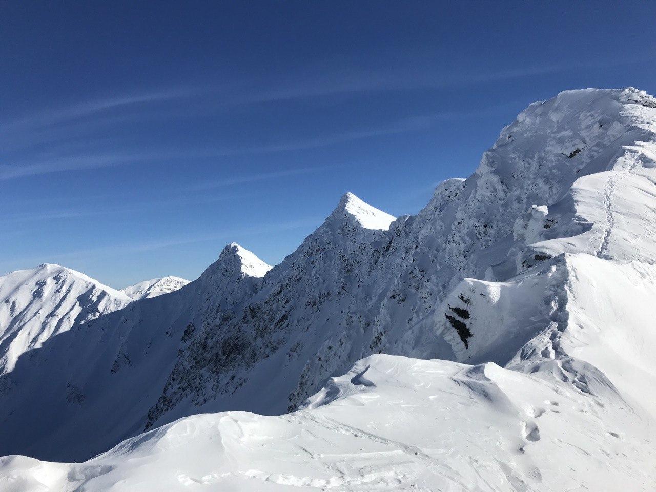
The ascent towards the Saddle gradually becomes steeper, so-called “zigzags” (ski mountaineering turns) come to use. The Saddle itself is a pleasant plain with a beautiful view in the north with the massif of Plačlivý and Ostrý Roháč peaks in the south to Liptovská kotlina (Liptovská basin) and Baranec peak.
Way down
It leads almost identically to the ascent route. The Smutné Saddle is often skied. The central slope can sometimes be ridden by skiers and thus bumpy, otherwise, it is a wide gutter with a pleasant slope. In the upper part it is narrower, gradually expanding, reaching an inclination of more than 35°. Paradoxically, the most difficult section of the descent is in the knee timber zone, below the so-called the Terrace, because the descents from the surrounding hills converge and the space between the knee timber trees is quite narrow. Then, only the former ski slope follows back to Žiarska chata, which is an ideal place for refreshments after the hike. In case of sunny weather in the spring, the terrace on the south side of the cottage is a great place to relax, recharge your batteries and draw energy from the sun. From the hut to the parking lot, it is already a pleasant descent along the summer road.
Symbolic cemetery for the victims of the Western Tatras – the cemetery was created by the Mountain Rescue in the Western Tatras to the growing number of victims of mountain accidents over the last two decades and taking into account the efforts of survivors and friends to place memorial symbols in places of accidents.
Medvedia štôlňa tunnel – is the longest tunnel in the Massif of the Western Tatras and at the same time the only accessible old mining spot in Liptov. The underground spaces reveal the secrets of mining work, the methods of transporting mining material and the obstacles that miners encountered while working.
By bus: there is a stop in the valley, but the buses come only occasionally
By car: large-capacity, unguarded, paid parking lot with toilet, right at the beginning of the route
Žiarska chata – there is a hut’s kitchen and a cantine with a rich offer of drinks and meals. Please note that card payment is not possible.
Žiarska chata – we recommend booking accommodation in advance due to the popularity and availability of the hut. Weekends are often booked months in advance.
In the vicinity of the parking lot there are several other facilities that also offer restaurant and accommodation services – Hotel Spojár, Salaš Žiar, hut Kožiar, hut Třinec.
+
change from a valley to alpine terrain in a short time
views
infrastructure: parking, hut
good snow conditions during almost the whole season
–
rare bus connections
high traffic