


Winter closure: the ski mountaineering season lasts 15.12. – 15.4.
The best time for the trip: spring (March, April)
Equipment: depends on the conditions, ski crampons are recommended, crampons and ice axe – in case of icy conditions, avalanche equipment is necessary
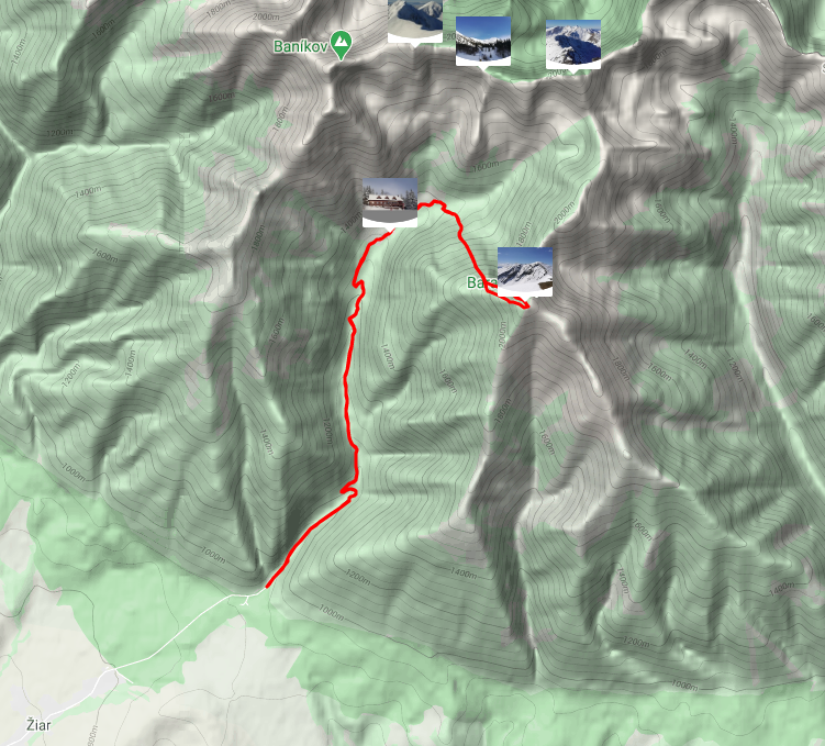
Route description
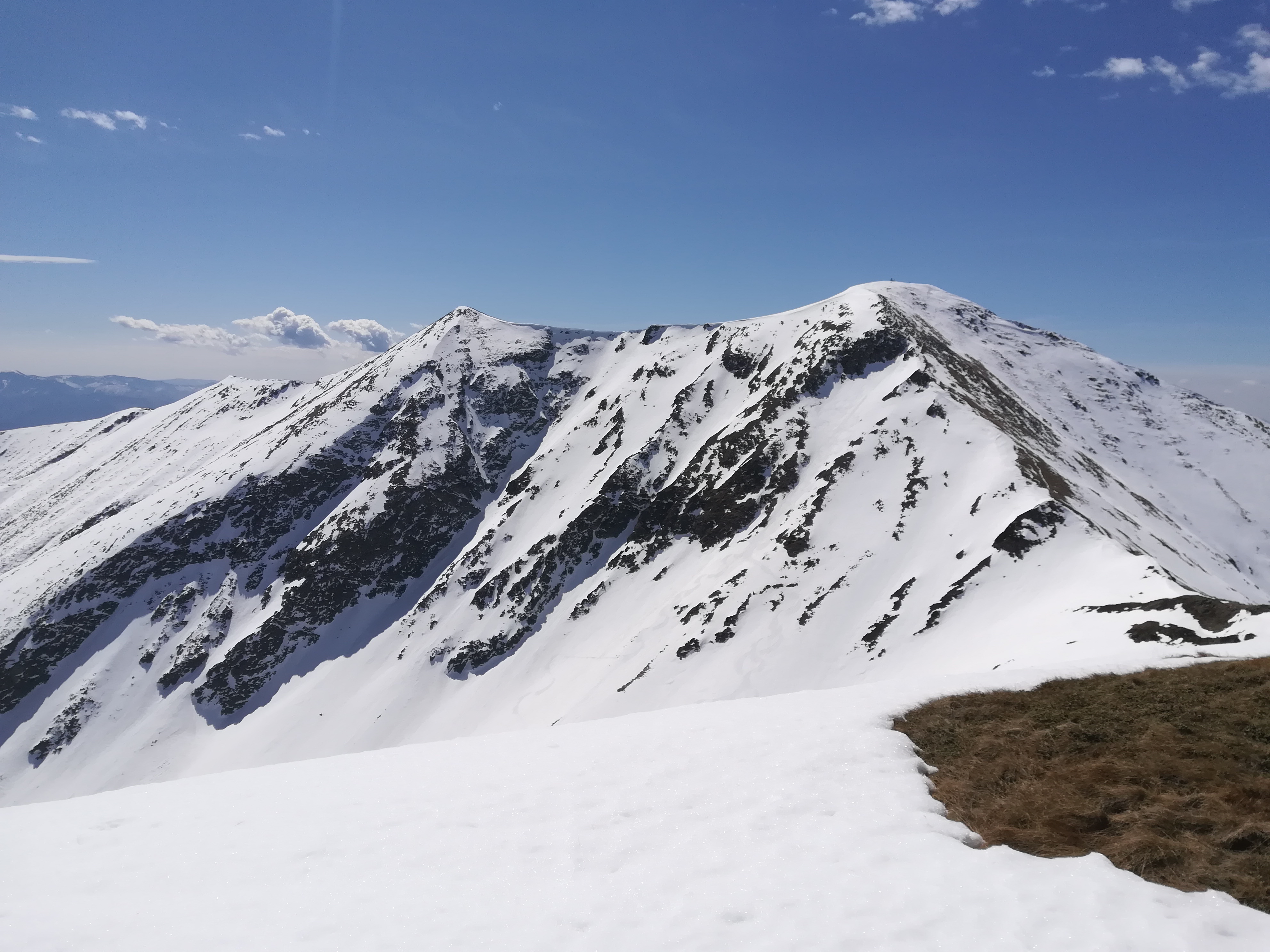
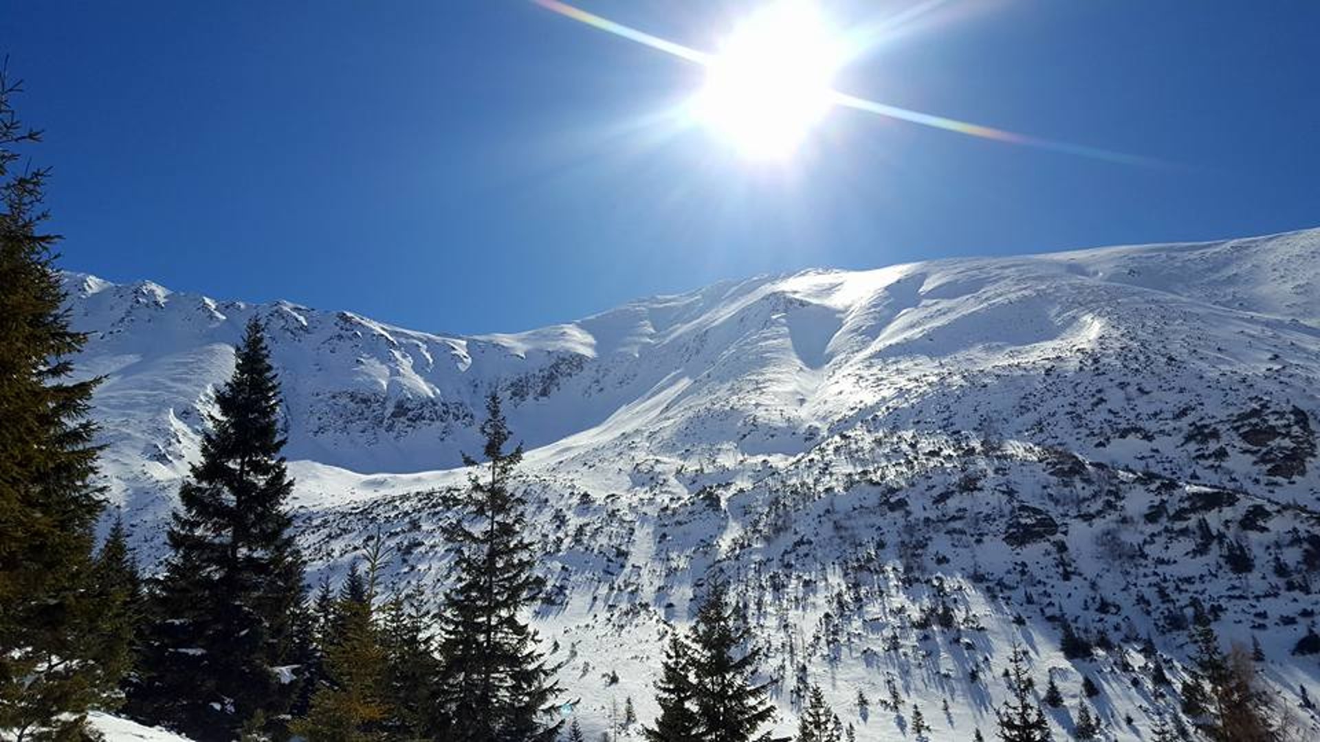
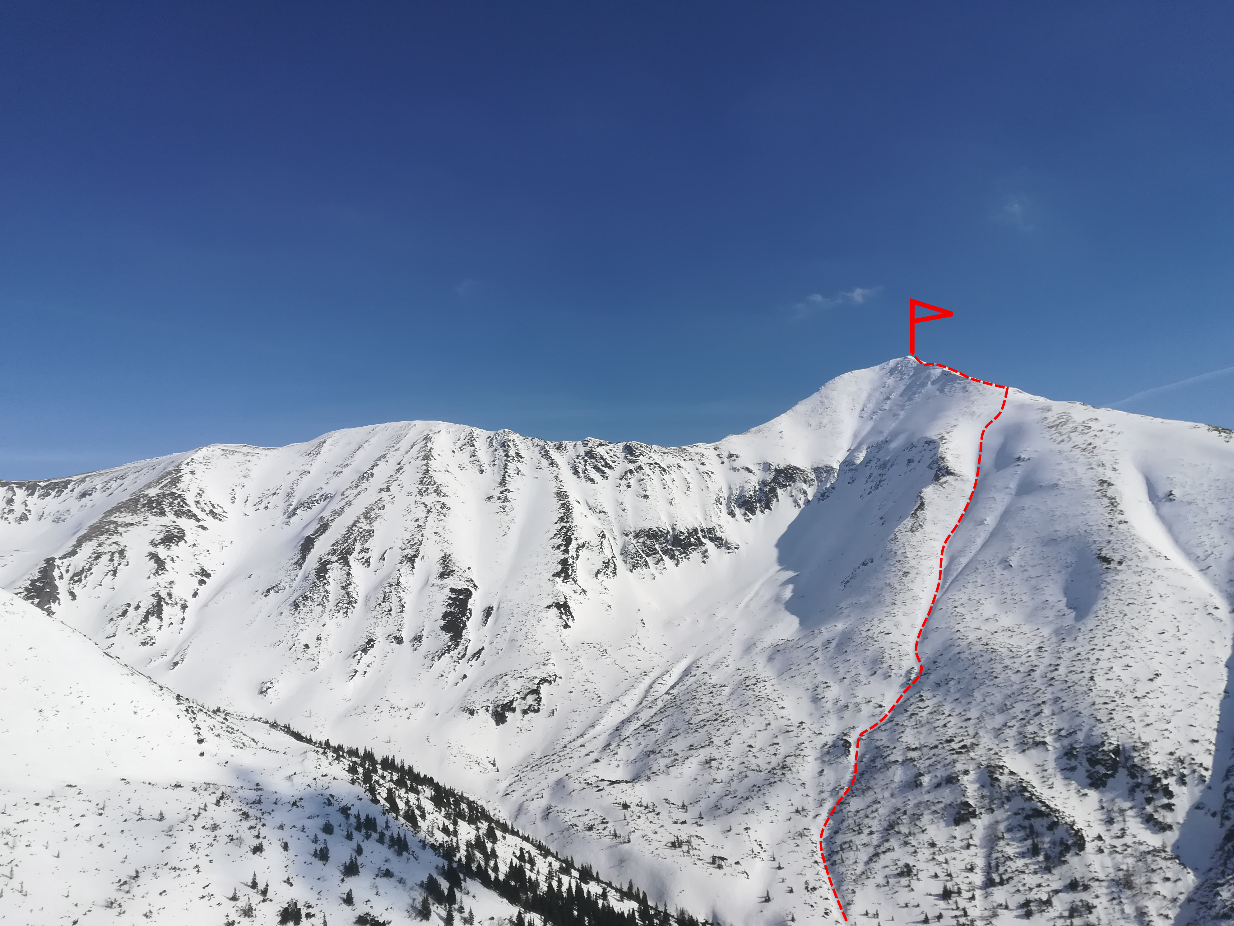
Baranec is the dominant peak of the Žiarska valley and within the Western Tatras also one of the highest hills with a height of 2185 meters. A large part of the route is completed on foot, so it is necessary to have mastered the movement in crampons and the use of ice axe. Also, most of the route is oriented northwest, so there is almost no sun in this area during the winter months. It is therefore often possible to find powder snow here, even though in other parts of the valley it has long since been transformed by sunlight.
However, such shady and steep slopes can be very dangerous, especially in December and January, when the sun’s rays do not reach here, so snow stabilization process is not possible and unstable layers of snow can form. Therefore it is recommended to enjoy this route at the end of March, or at the beginning of April, when the snow in this area is already relatively stabilized and it is too hot on the other slopes. However, due to the inclination, it is always necessary to monitor the current conditions and the development of the avalanche situation.
Way up
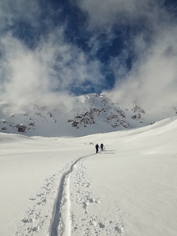
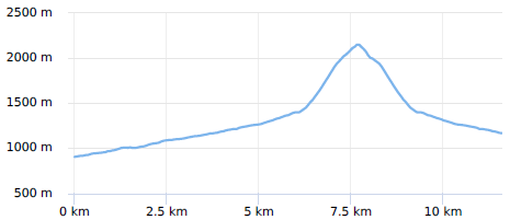
The route starts at the mouth of Žiarska valley (Žiarská dolina), right at the parking lot. The valley has an elevation of about 400 meters in 5 kilometres distance, It is sometimes ridden by a snowmobile, or has a ski track already made by other ski tourers.The route passes smoothly around Žiarská chata, which is an ideal stop for refreshments before the ascents gets more demanding (and steeper).
From Žiarská chata, the ascent leads towards the former ski lift, to the right of the tourist trail. From the so-called an old ski lift route crosses a stream. In case of a heavy winter it can be frozen, but even during weaker winters it is not a problem to skip it. A suitable place for its crossing is in the middle of the old slope. It is often possible to follow the track of other ski mountaineers, or it is possible to use gps navigation and gpx coordinates, which are part of the article.
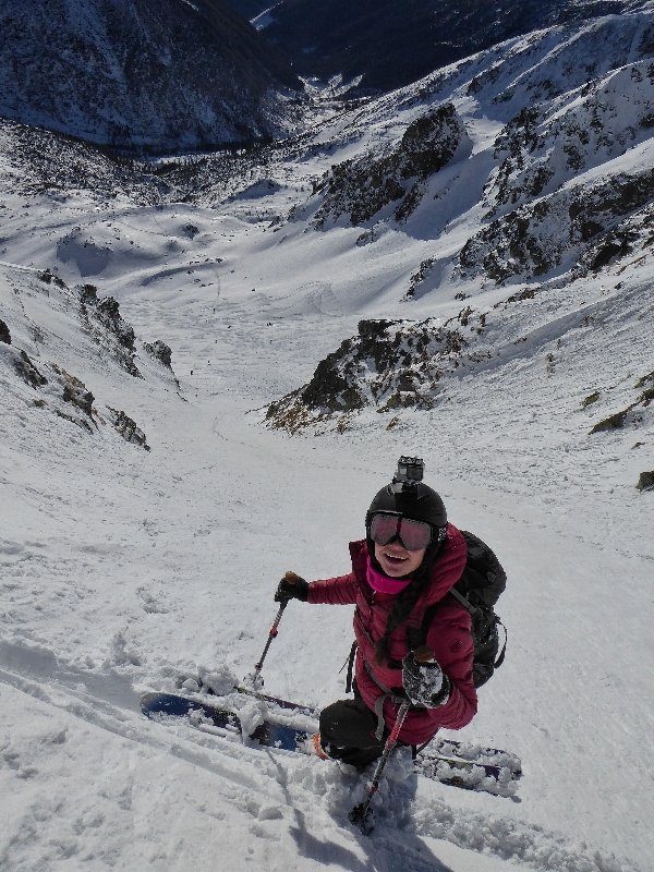
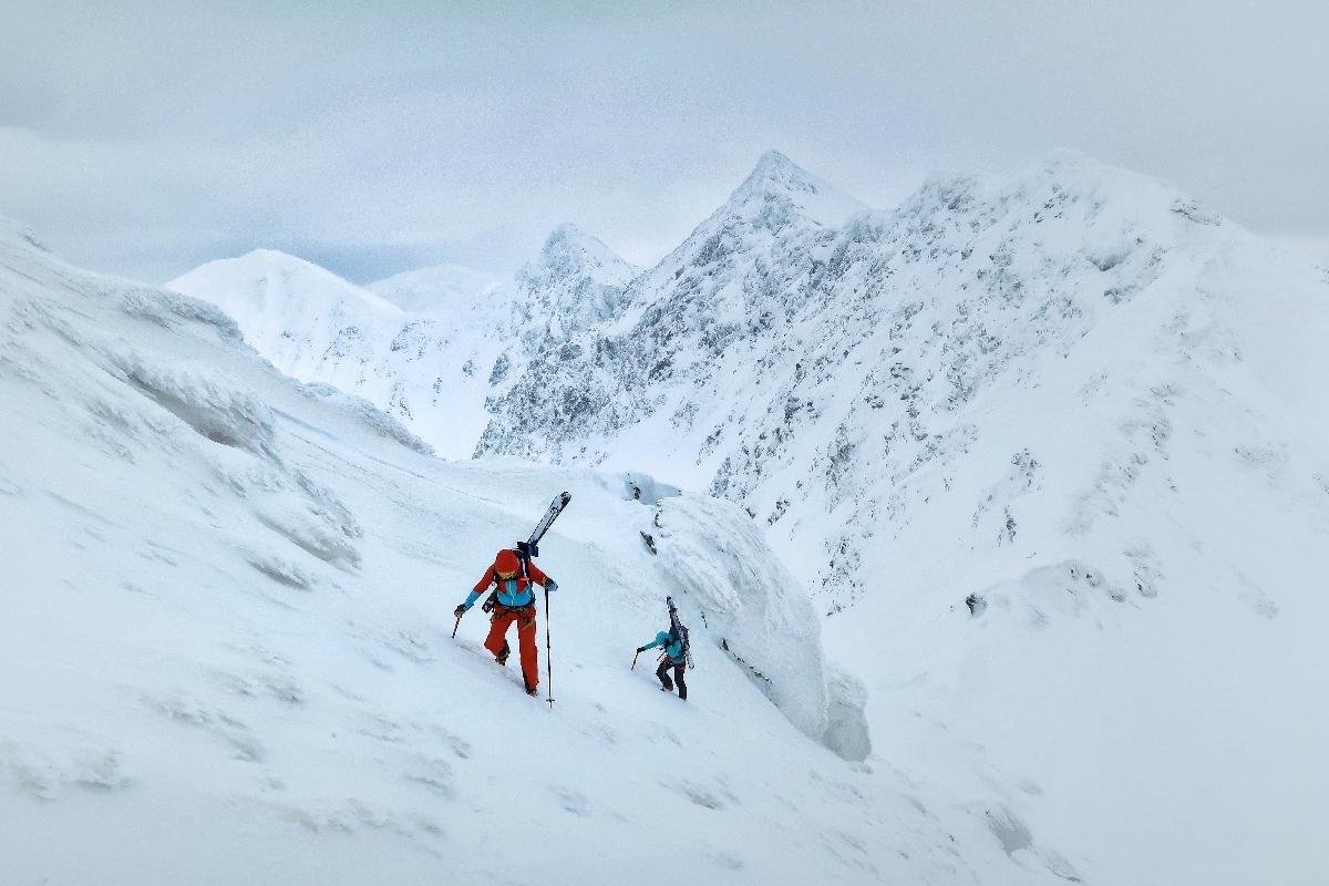
At the beginning, the slope still allows climbing on the skins, but then the couloir is already steep, and it is more advantageous to go on foot or on crampons with skis on a backpack. The entire ascent from the crossing the stream has an elevation gain of almost 800 meters, which can be challenging even for skilled ski mountaineers. The advantage of this steep ascent is that the ridge can be reached relatively quickly. The last part the ascent leads along the ridge to the very top. This part can be wind-blown up to the grass and rocks.
Way down
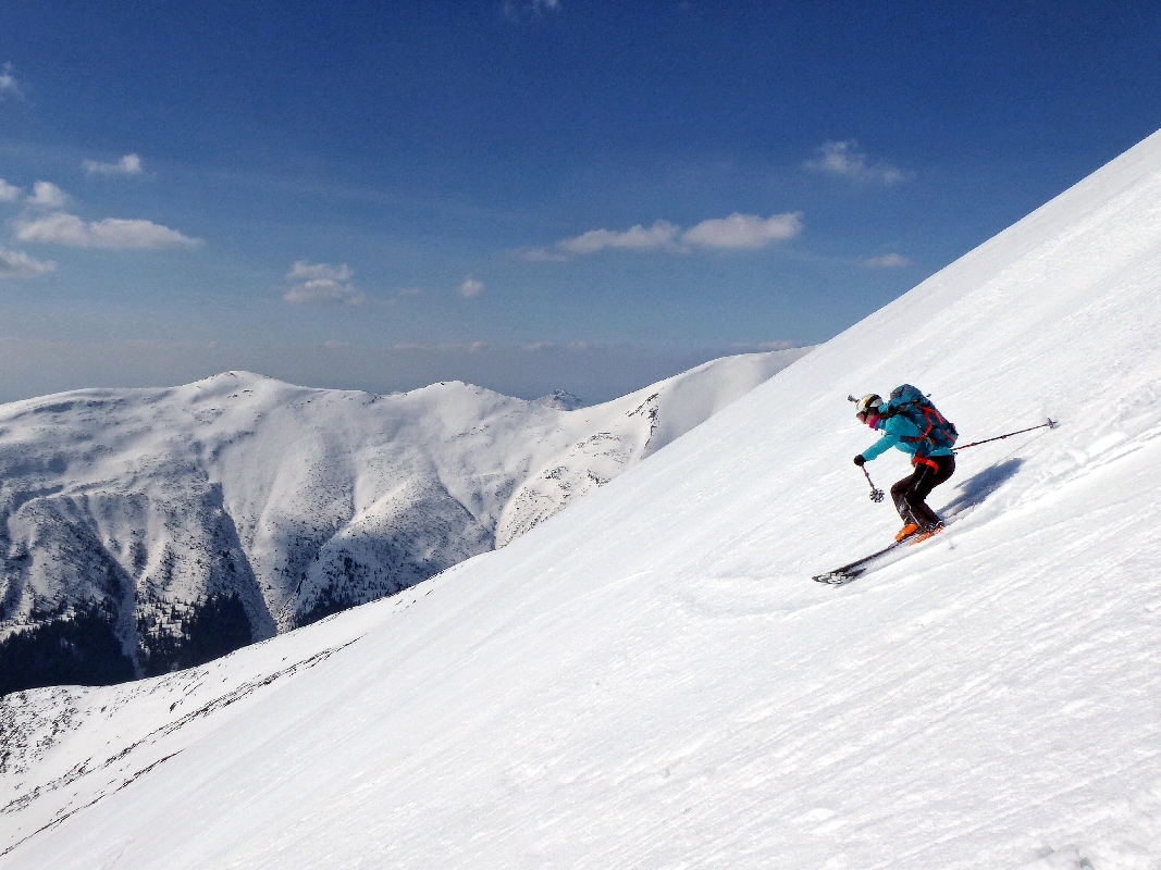
The descent has several variants. Directly from Baranec there are three main slopes: Hungarian, Spring and Central. The most difficult is the Central one, because during mild winters there is a small icefall in its middle. The other two are easier, but are only recommended for experienced and good skiers. Less experienced skiers can use the option of continuing along the ridge towards peak Smrek, or up to Žiarské sedlo (Žiarske Saddle).
From the ridge there are nice views all around and the descent from Žiarské sedlo should not be a problem even for slightly weaker skiers. However, it is very important to watch the conditions, because even here in the spring the snow can be very hard, it is often necessary to wait until the afternoon for the surface to finally soften and enjoy skiing.
Symbolic cemetery for the victims of the Western Tatras – the cemetery was created by the Mountain Rescue in the Western Tatras to the growing number of victims of mountain accidents over the last two decades and taking into account the efforts of survivors and friends to place memorial symbols in places of accidents.
Medvedia štôlňa – is the longest tunnel in the Massif of the Western Tatras and at the same time the only accessible old mining spot in Liptov. The underground spaces reveal the secrets of mining work, the methods of transporting mining material and the obstacles that miners encountered while working.
By bus: there is a stop in the valley, but the buses come only occasionally
By car: large-capacity, unguarded, paid parking lot with toilet, right at the beginning of the route
Žiarska chata – there is a hut’s kitchen and a cantine with a rich offer of drinks and meals. Please note that card payment is not possible.
Žiarska chata – we recommend booking accommodation in advance due to the popularity and availability of the hut. Weekends are often booked months in advance.
In the vicinity of the parking lot there are several other facilities that also offer restaurant and accommodation services – Hotel Spojár, Salaš Žiar, hut Kožiar, hut Třinec.
+
exposed, difficult downhill
thanks to the steep ascent quickly on the ridge
the snow stays here until late spring
–
avalanche risk in the winter
after the north-western winds, the couloirs lack snow