


Winter closure: the ski mountaineering season lasts 15.12. – 15.4.
Best time for the trip: all season with enough snow , but the best in the spring
Equipment: depends on the conditions, ski crampons are recommended, crampons – in case of icy conditions, avalanche equipment is necessary
Route description
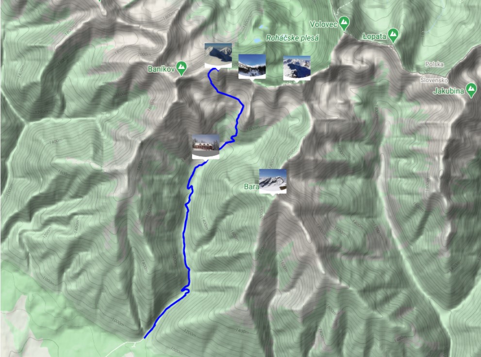
The goal is the peak between peaks Tri kopy and Baníkov in the main ridge of the Western Tatras. A grassy peak, which on the northern side is adjacent to the alpine ski area Zelená dolina (Zelená valley) on the Orava side of the Western Tatras. However, the route leads in free terrain, so it is not suitable for less experienced skiers or beginners (especially in the case of icy conditions).
Way up
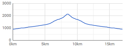
The route starts at the mouth of Žiarska valley (Žiarská dolina), right at the parking lot. The valley has an elevation of about 400 meters in 5 kilometres distance, It is sometimes ridden by a snowmobile, or has a ski track already made by other ski tourers.The route passes smoothly around Žiarská chata, which is an ideal stop for refreshments before the ascents gets more demanding (and steeper).
The route passes smoothly around Žiarská chata, which is an ideal stop for refreshments in front of the more demanding (and steeper) part of the ascent. Above the cottage it is already free unpaved terrain, initially slight with a slope of up to 30°. The key place in terms of navigation is in the woods, about 500 meters away from the cottage. Here, the road divides in the direction to the left into the area of Veľké Závraty (also direction of Hrubá kopa peak), and in the direction to the right to Malé Závraty (Plačlivé and Žiarske sedlo).
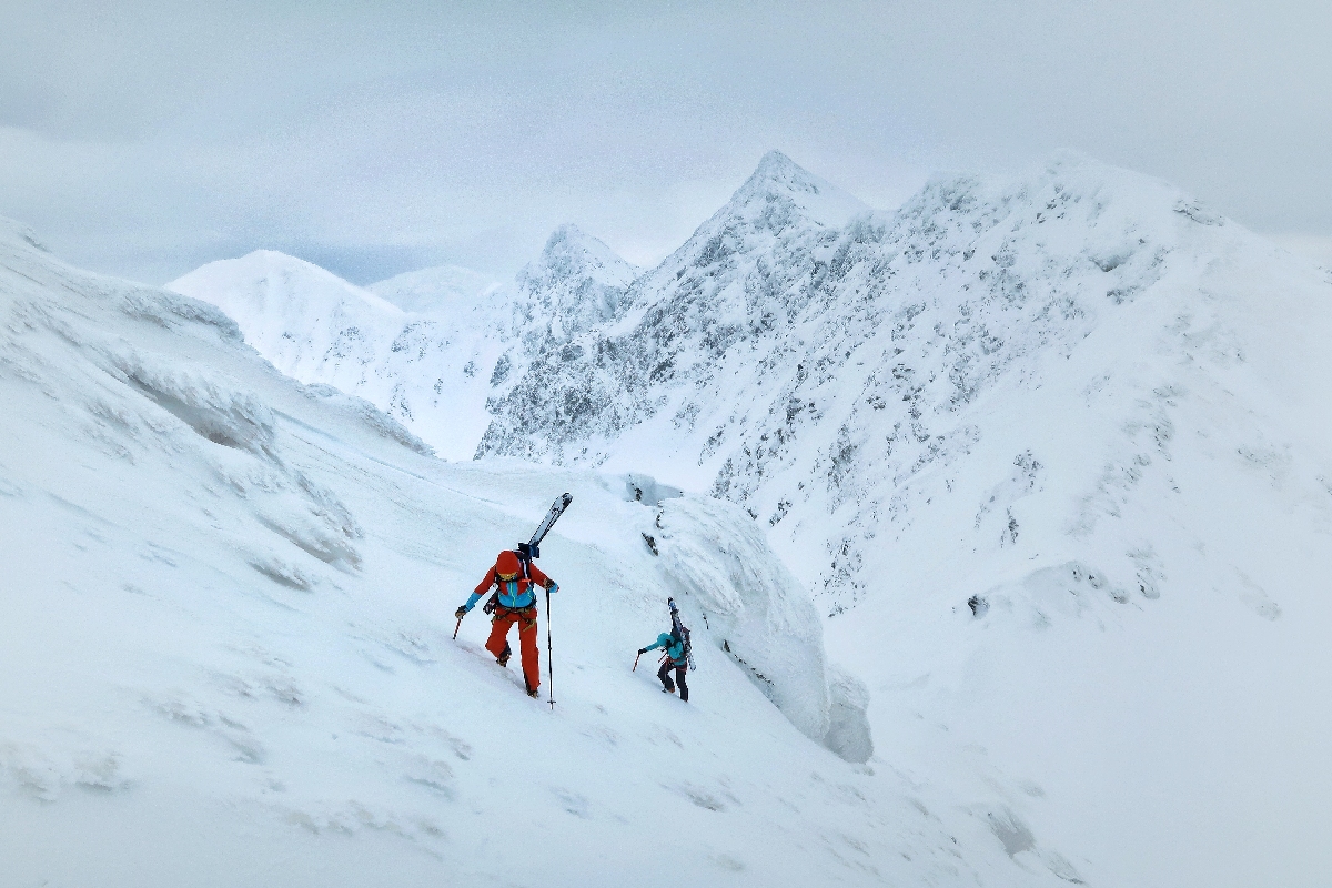
The mentioned crossroads is followed by a steep section between knee timber trees. This section is often slippery, hard, with bumps, and sometimes it is necessary to use ski crampons at this point. It is also narrow, and therefore it is necessary to pay attention to skiers had chosen to hike earlier and are already returning downwards.
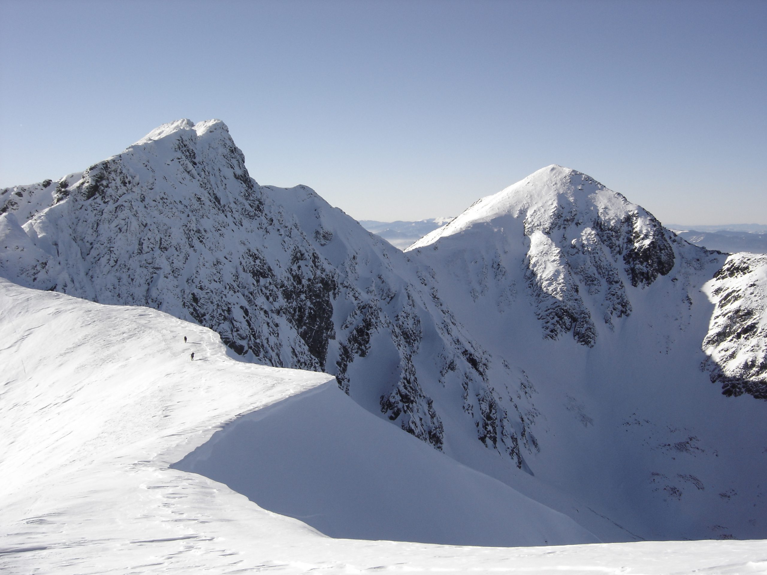
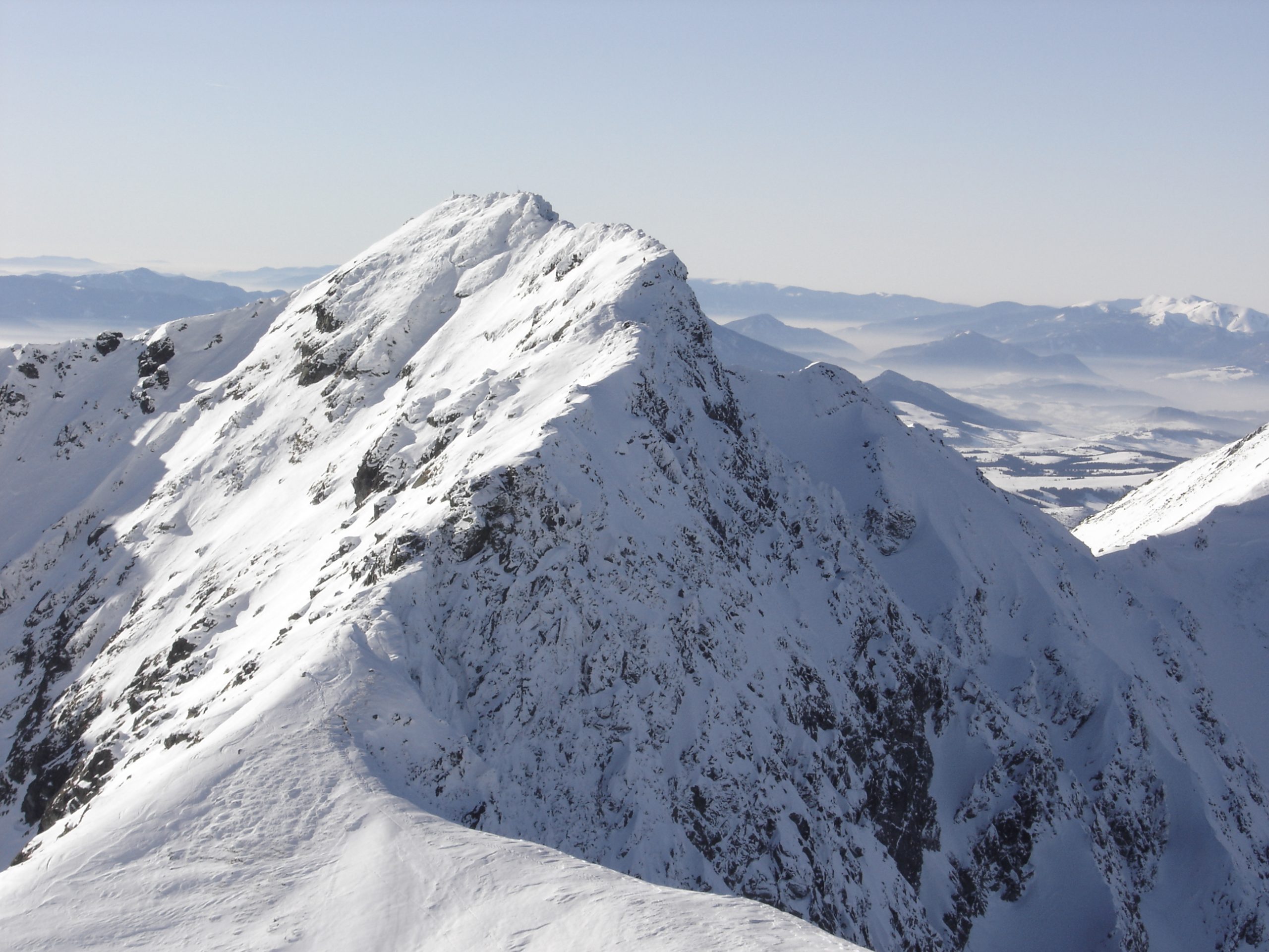
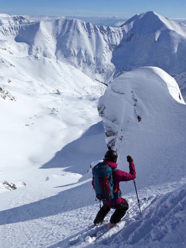
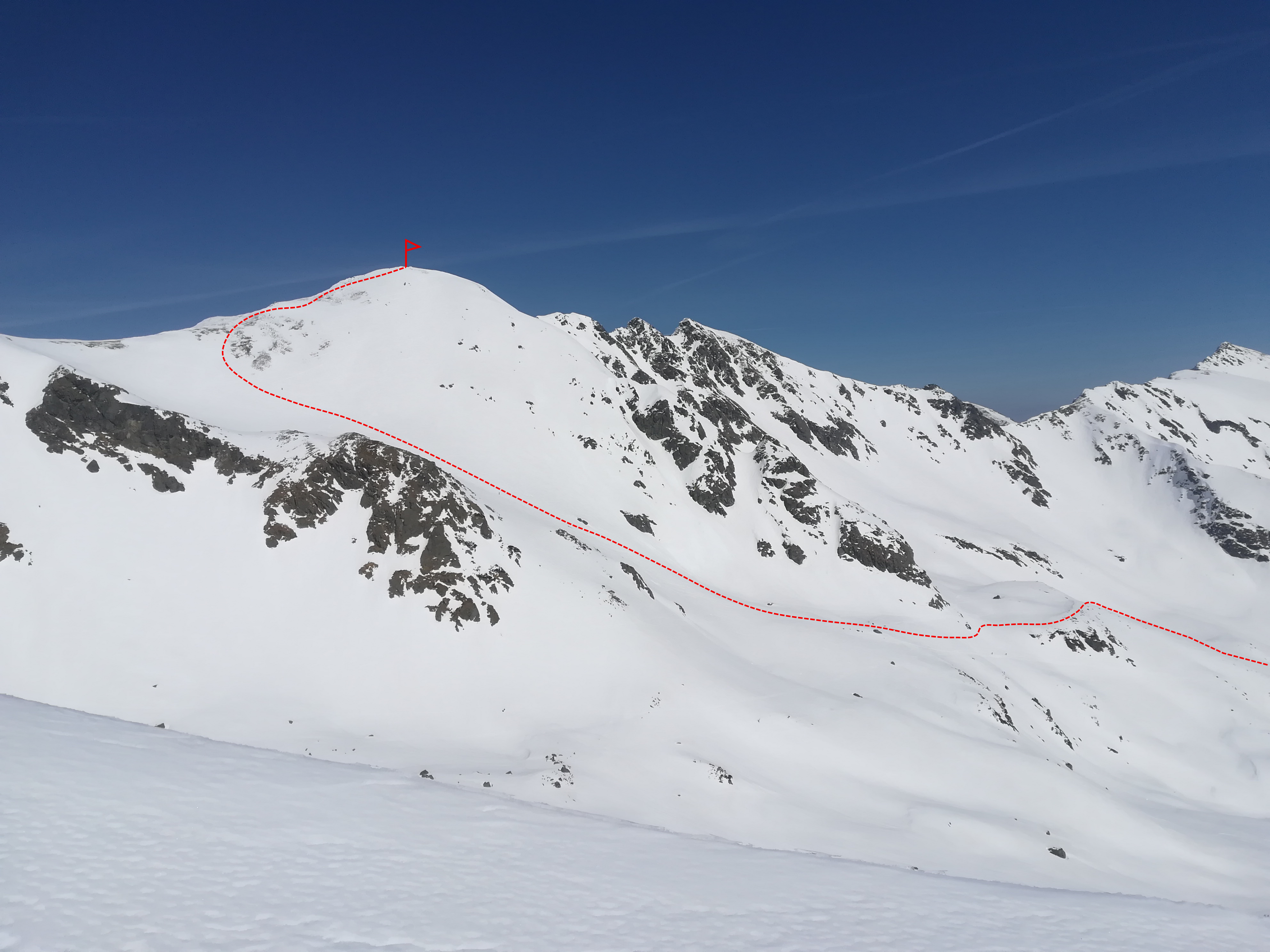
The terrain will subside after about 500 meters and the route leads through the so-called Terrace. Just above the terrace there is the area, which gets threatened by avalanches often. The ascent leads to the left towards the meteorological station of the Avalanche Prevention Center. From there, the traverse continues even further to the left under the rock face. This place can also be dangerous in terms of avalanches, so be careful here. The Terrace continues towards Lúčné sedlo (Lúčne Saddle). If the conditions are bad it is possible to end the hike here, at an altitude of approximately 2050 masl.
From the Saddle it is only about 200 meters of elevation gain more to Hrubá kopa peak. The conditions are very diverse here, but often the ridge to the top is wind-blown up into ice or hard snow, so it is often necessary to use crampons, or to proceed on foot with skis on a backpack.
Way down
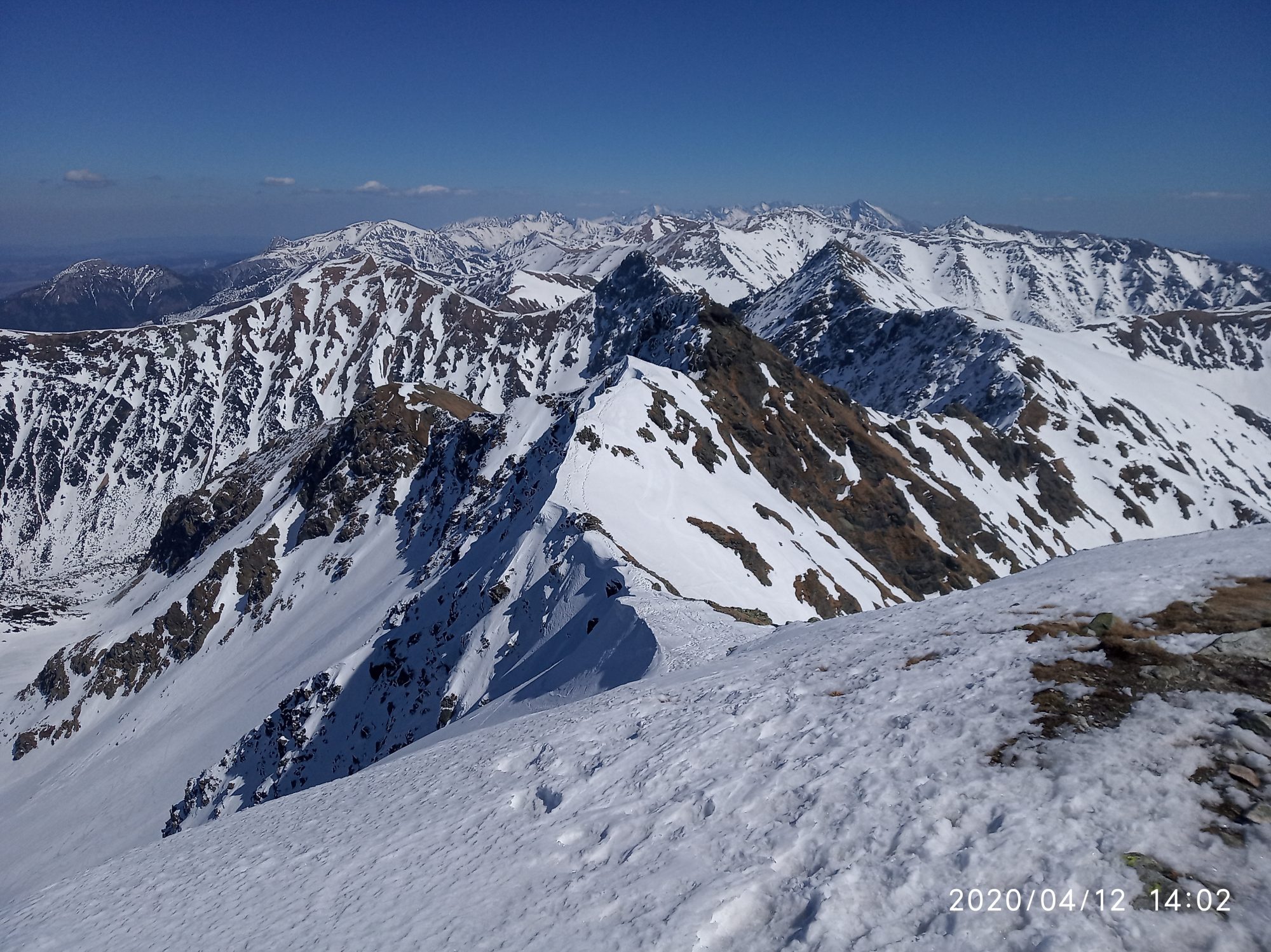
It leads almost identically to the ascent route. Descent, very pleasant, is almost entirely facing south, so excellent skiing is enjoyed in the spring. However, powder snow will not last very long in this area. Conditions can be complicated by wind, as frequent northwest winds sometimes create unpleasant snow slabs.
This peak is skied often. It is also possible to use the option to ski the couloir between Hrubá kopa and Tri kopy peaks (so-called Madajov couloir). However, it is significantly steeper and also significantly more dangerous in terms of avalanches.
Symbolic cemetery for the victims of the Western Tatras – the cemetery was created by the Mountain Rescue in the Western Tatras to the growing number of victims of mountain accidents over the last two decades and taking into account the efforts of survivors and friends to place memorial symbols in places of accidents.
Medvedia štôlňa tunnel – is the longest tunnel in the Massif of the Western Tatras and at the same time the only accessible old mining spot in Liptov. The underground spaces reveal the secrets of mining work, the methods of transporting mining material and the obstacles that miners encountered while working.
By bus: there is a stop in the valley, but the buses come only occasionally
By car: large-capacity, unguarded, paid parking lot with toilet, right at the beginning of the route
Žiarska chata – there is a hut’s kitchen and a cantine with a rich offer of drinks and meals. Please note that card payment is not possible.
Žiarska chata – we recommend booking accommodation in advance due to the popularity and availability of the hut. Weekends are often booked months in advance.
In the vicinity of the parking lot there are several other facilities that also offer restaurant and accommodation services – Hotel Spojár, Salaš Žiar, hut Kožiar, hut Třinec.
+
long descent
views
infrastructure: parking, mountain hut
good snow conditions almost the whole season
–
long ascent
poor bus connections
High traffic (tourists)