


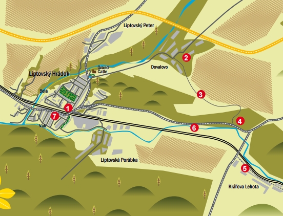
Liptovský Hrádok, Hradná ulica, in front of the forestry school building – Socha Raneného diviaka (Statue of the Wounded Wild Boar) (1), Dovalovo – Catholic church with the houses of Liptov masons at the upper end (2), from there you will pass by Kaplnka nad Dovalovom (the Chapel above Dovalovo) (3) along the meadow-forest road to Červený kút (4). Then after a short section along the I./18 road you will reach Štróblova vila (Štróbl’s villa) (5) and take a peek at the Mašiansky balvan boulder. The way back leads through Liptovská Porúbka (6) to Liptovský Hrádok (7).
(1) Liptovský Hrádok – Statue of the Wounded Wild Boar
The Statue of the Wounded Wild Boar, from 1902, came from the workshop of the important sculptor Alojz Štróbl, born in today’s Kráľova Lehota, in the past a settlement that was part of Liptovský Hrádok. The original statue was first located at Štróbl’s villa in Kráľova Lehota, from where it was later moved to the English park in front of the Jozef Dekret-Matejovie Forestry School, where it stands to this day. In 2011, the Town of Liptovský Hrádok classified it as an important monument.
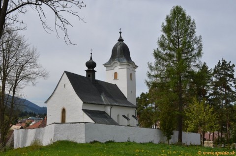
(2) Dovalovo – Catholic church
Go along Hradná ulica, past the castle and the manor house with its lake, and you will reach the Dovalovo district, where the Early Gothic Roman Catholic Church of St. Martin is located, dating from the second half of the 13th century, and a defensive wall from the 17th century.
DOVALOVO – HOUSES OF LIPTOV MASONS At the upper end on the right side of the road along the marked bike trail, you can admire the masonry art of the celebrated Liptov masons, who became famous for the construction of Pest (today’s Budapest). The most famous of them was undoubtedly Ján Nepomuk Bobuľa, and you can stop by the house in which he was born on your way.
(3) Chapel above Dovalovo
Climb a steeper hill to get to the most beautiful place in Dovalovo, the chapel, offering a beautiful and extensive view of the surroundings with the Tatra peaks in the background. According to tradition, the chapel was built after a tragic event in 1692 (a shepherd and his oxen were killed here during a storm).
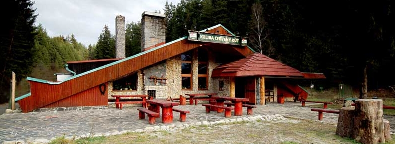
(4) Červený kút
Go along the forest path using the green bike trail to get to the Červený kút locality, where you can relax and recharge your batteries enabling you to uncover more attractions on the route.
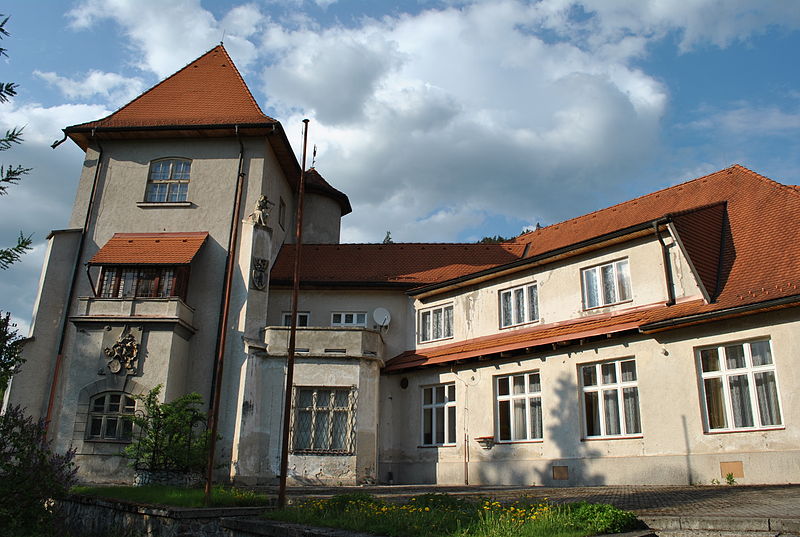
(5) Štróbl’s villa – Kráľová Lehota
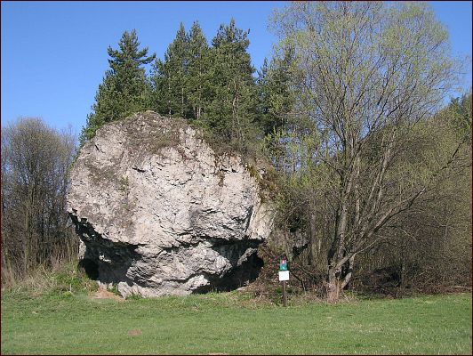
Alojz Štróbl was the most celebrated Hungarian sculptor in the 19th century. Although he worked in Hungary, he could never forget his home, Liptov. In 1891, he bought the house in which he was born in Kráľova Lehota, and converted it into his family residence. He transformed the original cottage into a copy of Vajdahunyad Castle, the seat of King Matthias Corvinus in Transylvania. By May 1906, the rough construction of the building and the tower was already finished. The servant buildings and outbuildings were completed in 1907. The artist had his studio on the ground floor of the tower, while the painting studio of his sister Žofia was above it on the first floor. If you cross the bridge and turn right after it, you will reach the left bank of the Váh River. About 2 km further on there is the Mašiansky balvan boulder. This is a unique stone formation – a boulder-like remnant of a river terrace created as a river island. The boulder is 20 metres high and is included among our natural monuments.
(6) Liptovská Porúbka
Follow the asphalt road under the mountain to reach Liptovská Porúbka after about 6 km. The bike trail is marked in red. The surroundings of the municipality offer a range of beautiful natural attractions for locals and visitors. Most of the cadastre is part of the Low Tatras National Park and its protection zone. The area includes the Ohnište National Nature Reserve. The ascent of Slemä (1513.7 m above sea level) is also interesting. During World War II, a transport plane crashed into the peak and the entire crew died. A memorial mound and a plaque with the names of the victims stand next to the remains of the plane. The hiking trail also passes by two partisan bunkers dating from World War II.
(7) Liptovský Hrádok – Námestie Františka Wisnera (František Wisner Square)
You are once again back home, in the town from which you set out on your cycling journey. Just looking at the eye of the fountain in the centre of the square will refresh you, not to mention the use of the summer terraces.
Starting point: 49.040797; 19.728577
There are paid and free parking spaces in Liptovský Hrádok.
Take the train or bus to Liptovský Hrádok and then the bus from Liptovský Hrádok to the surrounding municipalities. It is best to complete the route by bike or on foot.
There are several accommodation facilities in Liptovský Hrádok. There are also food options in both summer and winter, in the hotel’s restaurants or snack buffets.