


Winter closure: the ski mountaineering season lasts 15.12 – 30.4.
Best time for the trip: the whole season
Equipment: avalanche equipment
Route description
The aim of the route is Ďumbier, the highest peak of the Low Tatras. The trip can be extended by a visit to the M. R. Štefánik Hut (Chata M. R. Štefánika) in Sedlo pod Ďumbierom, which is located 400 meters lower, but then the way back would require to follow the same part of the trail with 400 meters of elevation gain. The descent can be skied in free terrain from Krúpova hoľa, less experienced skiers are advised to continue along the ridge to the nearby Chopok and continue down the ski resort slopes.
Way up
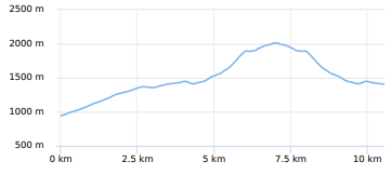
The starting point is the parking lot in Lúčky. The first part of the ascent leads along the “Turistická” ski slope, which is one of the least steep in the Jasná resort. The ascent route leads along it for about 2.5 km and 400 altitude meters. Later, it continues into the red marked trail at the lower station of the lift to Pekná vyhliadka. The route turns to the left into the forest and continues along the hiking trail slightly down the hill and then through the traverse towards the mouth of the Široká valley. This part of the route is mostly located in the forest and the first views appear at the mouth of the Široká valley.
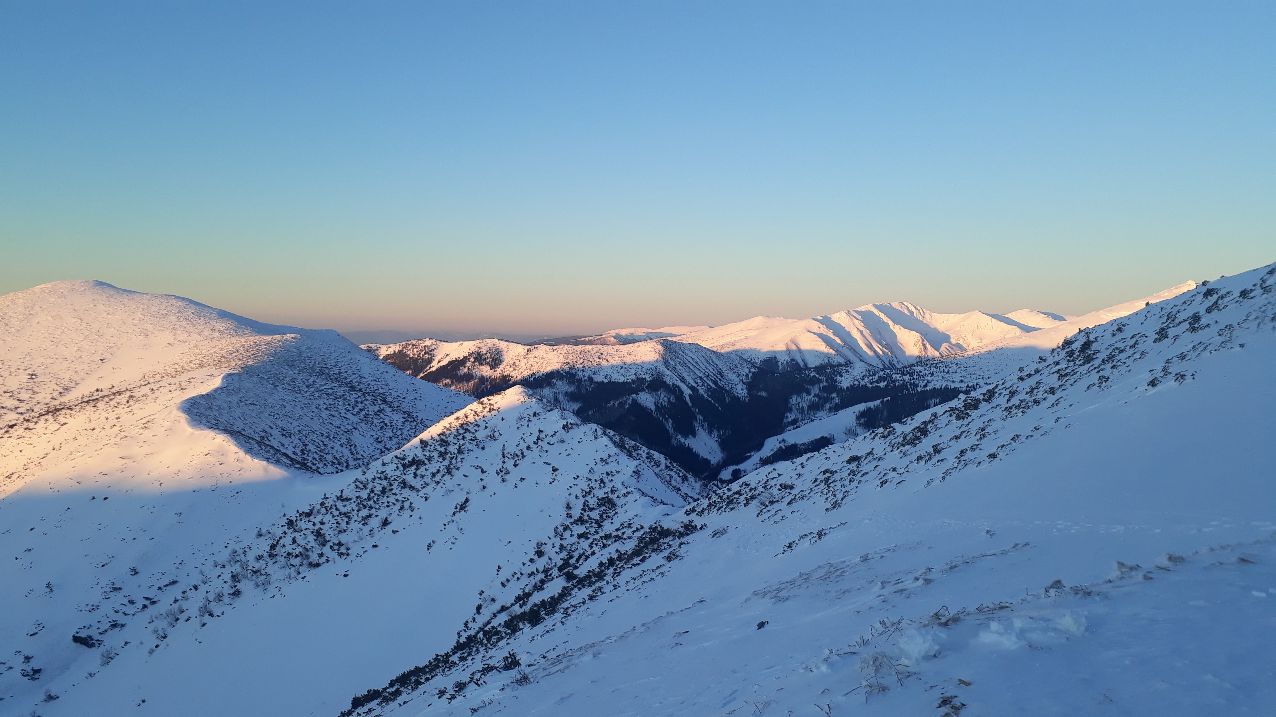
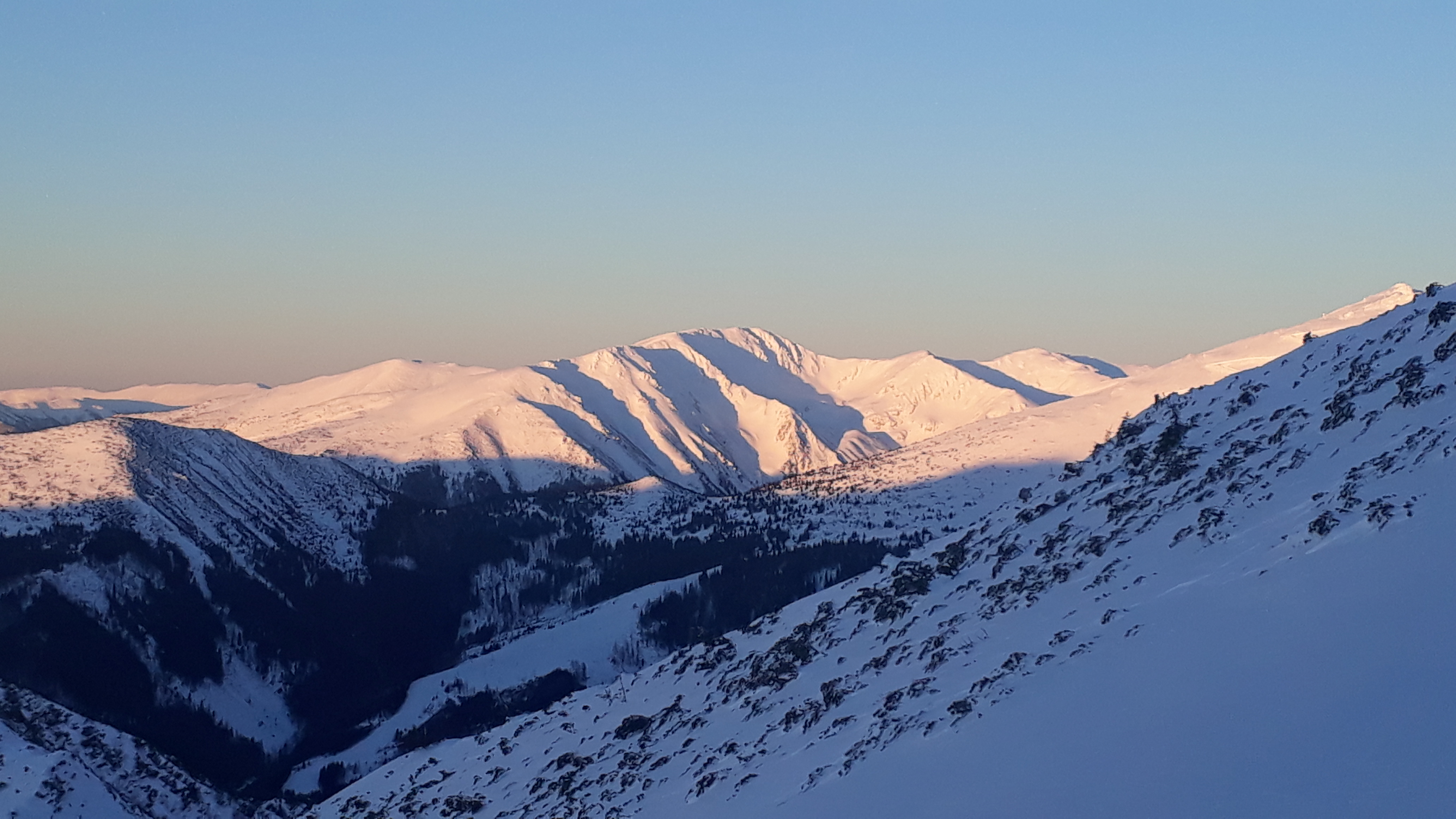
The ascent continues up in Široká dolina and copies the summer green marked tourist trail to Krúpova hoľa. The slope of the ascent gradually increases. However, a slightly gentler ascent can be completed in the left part towards the Kráľov stôl and then along the ridge to Krúpova hoľa. The route continues to the main ridge of the Low Tatras and the red marked tourist trail. It is already close to peak Ďumbier – about a kilometer, with an ascent of about 120 meters.
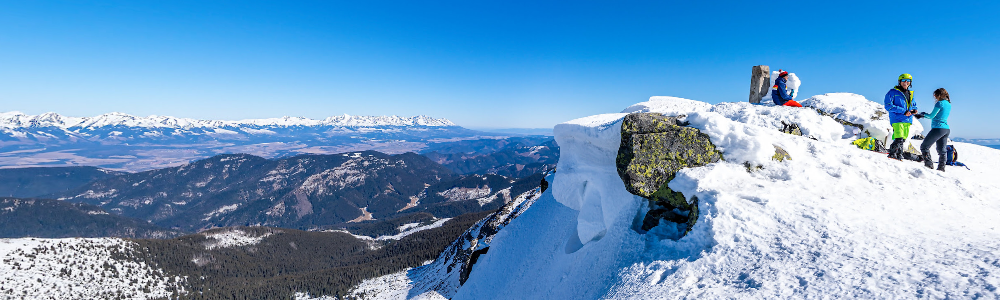
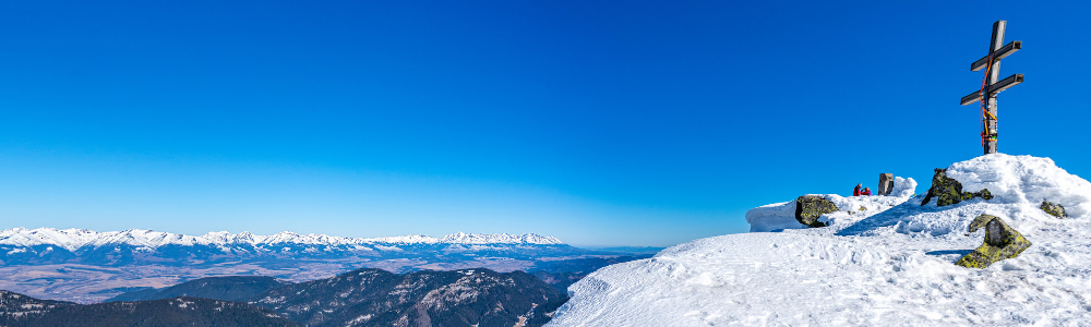
A concrete pylon with a a large double door cross has been built on the top of Ďumbier. The peak also offers an extensive circular view of virtually all the mountains of central and northern Slovakia.
Way down
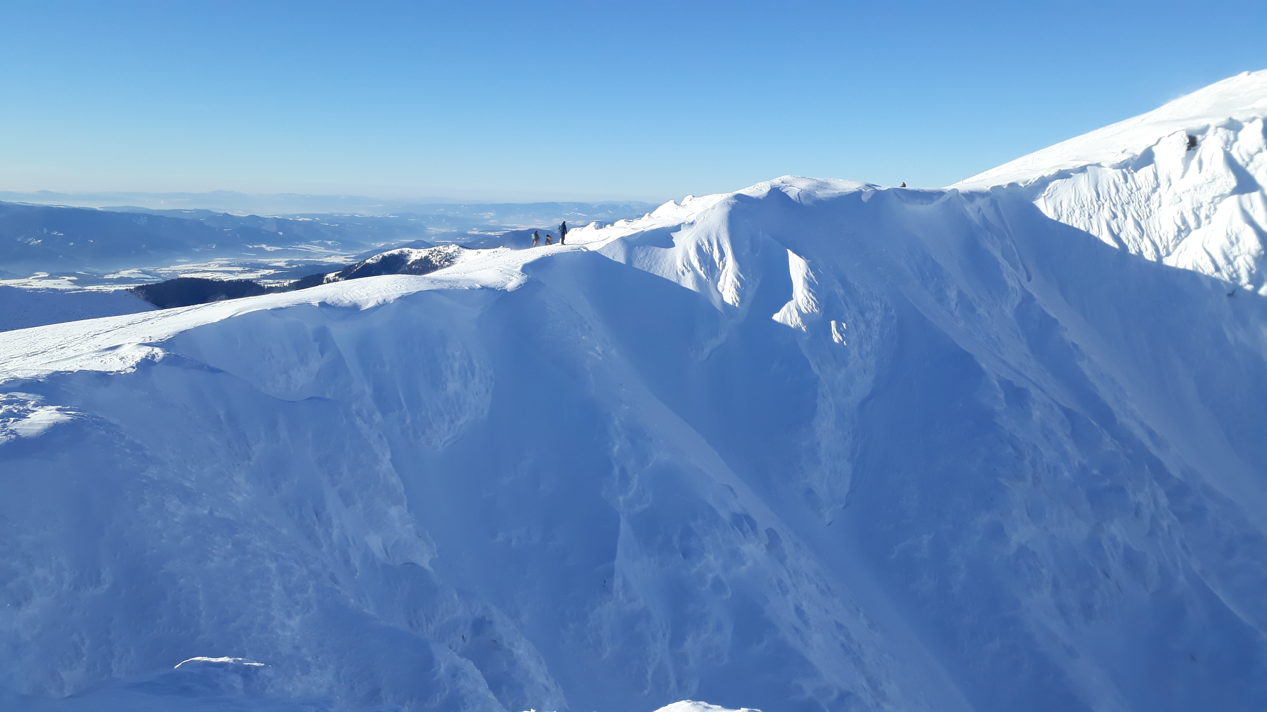
Directly from the top, return about a kilometer along the ridge and enjoy a descent from Krúpova hoľa, where the northwestern slope offers good skiing.
Less experienced skiers can continue along the ridge to Chopok and complete the descent on ski slopes. In case of lack of snow or in the spring, it is possible that ridge will miss snow and the skies would need to be carried in hands.
Educational trail Demänovská dolina – On the route Jasná – Tri vody – Luková – Široká dolina – Lúčky there are 9 information boards and benches for a pleasant rest. Natural and artistic elements along the route explain more about the dragon, which allegedly lived in the surrounding caves.
National Nature Reservation Ďumbier – spreads over the top of Ďumbier in the main ridge and on the northern slope at the end of the valleys. The protection is focused on the alpine landscape of rocky hills and gutters, knee timber stages and mountain coniferous forests with diverse fauna, flora and unique species.
Journey of the SNP Heroes – A red-marked tourist trail of European significance named in honor of the Slovak National Uprising, which is the dream of many tourists.
By bus: regular buses
By car: Lúčky parking lot
! Please note that the parking capacity may be full, especially during the high season from the early morning hours already
Several private cottages directly in Lúčky, hotels in Jasná
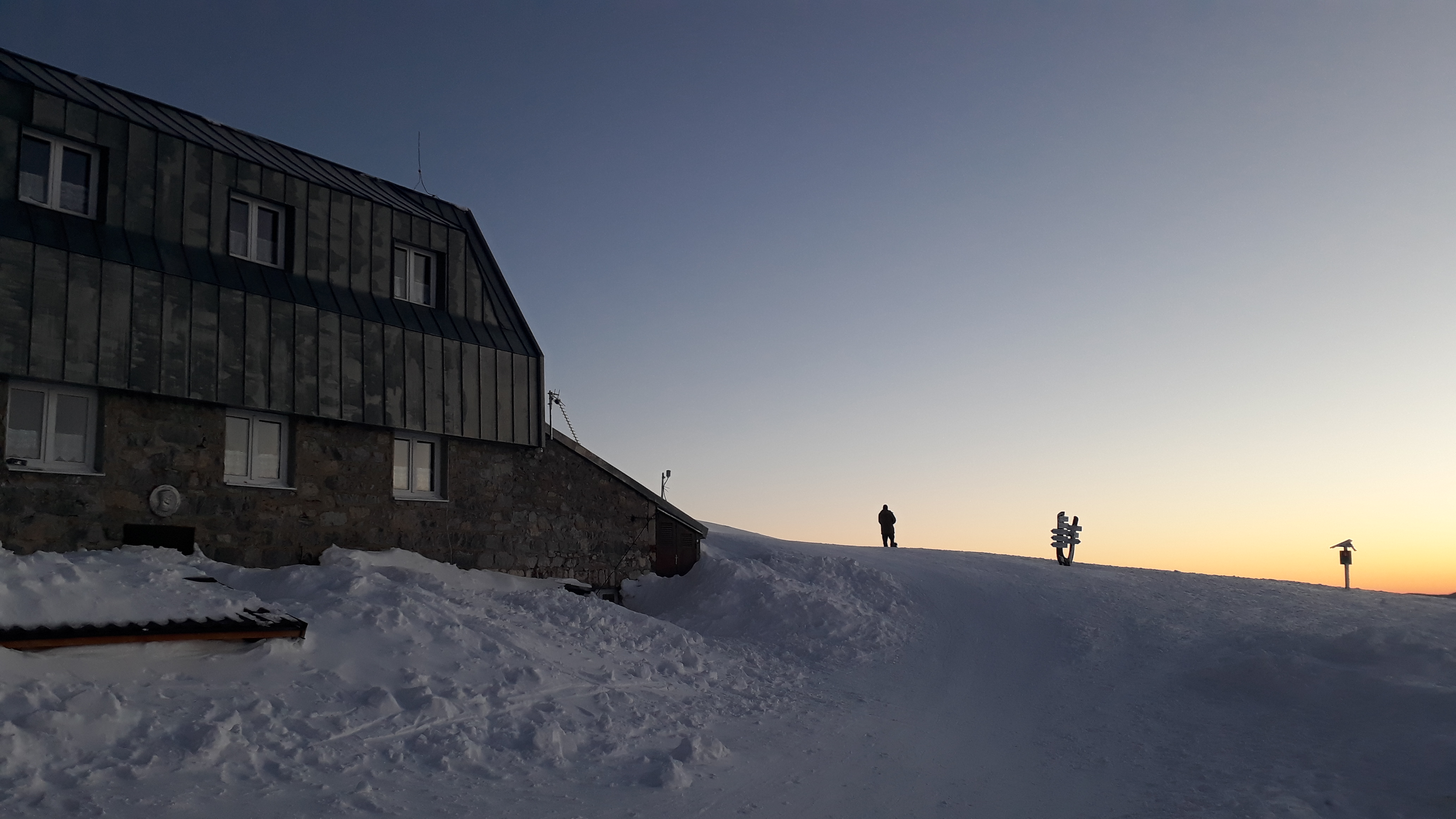
M. R. Štefánik Hut (Chata M. R. Štefánika) – open daily, all season, there is a hut’s kitchen available, as well as the possibility of accommodation.
+
infrastructure – hotels, parking lots, restaurants
possible transport by ski bus
long season due to the northern orientation
modified ski slope from the parking lot
views
–
ascent (and descent) on a narrow sidewalk in the middle of the route
full parking, traffic in high season
frequent strong wind on the ridge